Gamsjoch group
| Gamsjoch group | ||
|---|---|---|
|
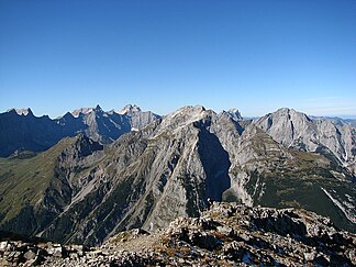
The Gamsjoch group from the Sonnjoch west flank, on the left the Laliderer Wand with Kaltwasserkarspitze and Birkkarspitze, on the right behind the Falkengruppe |
||
| Highest peak | Gamsjoch ( 2452 m above sea level ) | |
| location | Tyrol , Austria | |
| part of | Karwendels | |
|
|
||
| Coordinates | 47 ° 25 ' N , 11 ° 33' E | |
|
The Gamsjoch group from the Plumsjochhütte, on the left in the background the Laliderer Wand |
||
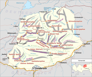
The Gamsjoch group is a mountain group in the Karwendel and includes the entire mountain range of the Gamsjoch . In the west the group is separated from the Falkengruppe by the Laliderer Tal , in the south it connects the Hohljoch ( 1794 m above sea level ) with the Hinterautal-Vomper chain . In the east lies the Sonnjoch group , from which it is separated by the Enger Tal with the Großer Ahornboden . The northern limit is the Riss valley .
On the eponymous and highest peak, the Gamsjoch ( 2452 m above sea level ), paths lead from the Großer Ahornboden either through a channel on the east flank directly to the Gumpenjöchl or alternatively via the Hohljoch and the Lalidersalm-Hochleger to the Gumpenjöchl. From there the route leads over the southern flank of the Gamsjoch to its summit. An ascent is also possible from the Laliderer Valley. The other peaks of the Gamsjoch group rarely receive visitors. The Falkenhütte and the Eng are ideal bases for tours in the Gamsjoch Group .
Major peaks (north to south)
- Unterer Roßkopf ( 1814 m above sea level )
- Roßkopfspitze ( 2015 m above sea level )
- Ruederkarspitze ( 2240 m above sea level )
- Gamsjoch ( 2452 m above sea level )
- Gumpenspitze ( 2176 m above sea level )
- Teufelskopf ( 1978 m above sea level )


