Garry (Tummel)
| Garry | ||
|
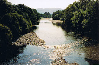
River Garry at Blair Atholl |
||
| Data | ||
| location | Perth and Kinross , Scotland | |
| River system | Tay | |
| Drain over | Tummel → Tay → Firth of Tay → North Sea | |
| River basin district | RBD Scotland | |
| Source lake |
Loch Garry 56 ° 49 ′ 17 ″ N , 4 ° 13 ′ 40 ″ W. |
|
| muzzle | north of Pitlochry in the Tummel Coordinates: 56 ° 43 ′ 5 " N , 3 ° 46 ′ 44" W 56 ° 43 ′ 5 " N , 3 ° 46 ′ 44" W
|
|
| length | 35 km | |
| Left tributaries | Allt Coire Luidhearnaidh, Bruar Water, Tilt | |
| Right tributaries | Errochty Water | |
| Communities | Blair Atholl | |
The Garry is a river in the Scottish Highlands in the Council Area Perth and Kinross . The River Garry is a fishing area that is particularly popular for trout .
course
The source of the Garry is Loch Garry . The river leaves the lake at its northern end. Shortly after leaving the lake, the Allt Coire Luidhearnaidh flows into the river. Then the Garry flows for 35 km to the southeast, to flow into the Tummel about three kilometers north of Pitlochry .
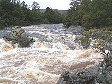
For almost its entire route, the River Garry flows through the Glen Garry along the A9 . After about 20 km on this route, it takes up the water of the Errochty Water and after about 25 km passes the village of Blair Atholl , where the River Tilt flows into the River Garry. Shortly before the mouth of the Errochty Water , the water of the Garry flows over several waterfalls popular with tourists.
Web links
- Description of the lake (en.)
- Information for anglers (en.)

