
Gebke (Meschede)
|
Gebke (upper course: Wallmecke / Kohlweder Bach ) |
||
 Fish ladders in Meschede, Lagerstraße |
||
| Data | ||
| Water code | DE : 276152 | |
| location | North Rhine-Westphalia , Germany | |
| River system | Rhine | |
| Drain over | Ruhr → Rhine → North Sea | |
| source | North of Eversberg 51 ° 23 ′ 29 ″ N , 8 ° 20 ′ 58 ″ E |
|
| Source height | 523 m above sea level NN | |
| muzzle | In Meschede in the Ruhr Coordinates: 51 ° 20 '54 " N , 8 ° 16' 38" E 51 ° 20 '54 " N , 8 ° 16' 38" E |
|
| Mouth height | 256 m above sea level NN | |
| Height difference | 267 m | |
| Bottom slope | 35 ‰ | |
| length | 7.6 km | |
| Catchment area | 13.755 km² | |
The Gebke is a 7.6 km long orographically right or northern tributary of the Ruhr in the North Rhine-Westphalian Hochsauerlandkreis , Germany .
geography
The brook rises about 2.2 km northeast of Eversberg in the Arnsberg Forest at an altitude of 523 m above sea level. NN as Wallmecke . Mostly flowing to the southwest, the stream changes its name after 2.9 km of the river with the mouth of the Aschholterbecke and is now called Kohlweder Bach . This is the name of the brook 1.4 km to the mouth of the Kleine Steinmecke , from where it is now called Gebke. A little later, the brook reaches the urban area of Meschede , where the brook is 256 m above sea level. NN flows into the Ruhr.
The Gebke overcomes a height difference of 267 m over a 7.6 km stretch of river, which corresponds to an average bed gradient of 35.1 ‰. The stream drains a 13.755 km² catchment area via the Ruhr and Rhine to the North Sea .
photos

The Wallmecke

Mouth of the Aschholter Becke in the Wallmecke
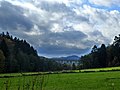
The Kohlwederbachtal

The Gebke flows into the Ruhr
.jpg)
.jpg)


Individual evidence
- ↑ a b German basic map 1: 5000
- ↑ a b Topographical Information Management, Cologne District Government, Department GEObasis NRW