Gierlinger Park
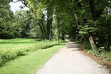
The Gierlinger Park has been a 3.4 hectare public green space in the Thalkirchen district of Munich since 1965 .
The property extends in a north-south direction on the slope edge of the Isar and includes the slope and a flat area below. To the north is the core of the formerly independent village of Thalkirchen with the Maria Thalkirchen church , to the south is the Asam-Schlössl by Maria Einsiedel . The park is part of an almost continuous chain of green spaces below the edge of the slope, which extends from Hinterbrühl over the Neuhofener Berg to below the Harras .
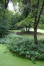
Several spring outlets on the slope feed a small watercourse, which is diverted underground to the raft channel . In the park there is a base for the horticultural department of the Munich building department, from where green areas in the wider area are looked after.
history
A house with spacious outbuildings has been found on the grounds of today's park since 1810, which belonged to Aloys Basselet von La Rosée . His family sold the property in 1855 to the appellate judge Dr. Konrad Pregler and his wife Josefine; the property was also sold in 1860, 1873, 1875 and 1879. In 1879 the owners Johann and Barbara Wolf built a new building, the property and buildings together were valued at 27,428 marks at that time. In the same year, the Wolfs exchanged the property with the pharmacist couple Otto and Klara Gierlinger for their property, and since then the property has been known as the Gierlinger property. The co-owner was the painter Josef Wagner, whom the Gierlingers paid out in 1885. Otto Gierlinger died in 1896, and Klara in 1907.
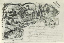
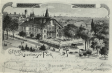
Thalkirchen was incorporated into Munich on January 1, 1900. That year, the son of the Gierlinger couple built a café and a restaurant with a garden at the north end of the property near the church. He expanded the leisure activities to include an alpine hut, a bowling alley and a pond for gondola rides. Concerts were held every day in summer. In doing so, he created a destination for excursion traffic from Munich, which had emerged from the pilgrimages to Thalkirchen. The operation was not economically successful. From 1904 the restaurant was empty, after the death of Klara Gierlinger the family closed all businesses on the property. By 1911, the builders Gebrüder Rank converted the restaurant building into the girls' institute Prinz-Ludwigshöhe-Thalkirchen, which was managed by Dr. Himmer was leased by the Gierlinger family and operated until 1916. From 1918, the social service of Catholic women headed the facility and opened several other offers on neighboring properties in the following years. The city of Munich had owned the house since 1921, which was largely destroyed in World War II.
After the war, the ruins were used by homeless people, and a refugee temporarily set up a beaver farm for fur production. When this was forcibly closed, the city decided to demolish the remaining buildings. The public park was opened in 1965. The social work for girls and women is continued by the social service of Catholic women on neighboring properties.
Web links
Individual evidence
- ↑ State capital Munich: Green area statute with green area directory , as of June 15, 2012
- ↑ a b Josef Bogner: Thalkirchen and Maria Einsiedel . In: Oberbayerisches Archiv 107, 1982, pp. 235–288, 251
- ^ Dorle Gribl , Thomas Hinz: Life in Thalkirchen . Culture in the south of Munich V. 1990, without ISBN, pp. 27-29
- ^ Social service of Catholic women: 100 years of social work in Haus Maria Thalkirchen , June 21, 2018
Coordinates: 48 ° 5 ′ 51.5 ″ N , 11 ° 32 ′ 32.7 ″ E


