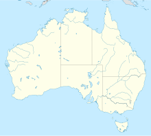
Giles Meteorological Station
| Giles | |||||||
|---|---|---|---|---|---|---|---|

|
|||||||
|
|||||||
|
|||||||
|
|||||||
|
|||||||
|
|
|||||||
[[Category: Place in Western Australia ]]
The Giles Meteorological Station (also Giles Weather Station or simply Giles ) is a weather station of the Australian Bureau of Meteorology in the far east of the state of Western Australia near the border with the Northern Territory .
location
The station is on the Great Central Road , the next village is the Aboriginal settlement Warakurna with 180 inhabitants, which is five kilometers north. The nearest major city is Alice Springs , 750 kilometers northeast; the Uluṟu is 330 kilometers away. Giles lies at the foot of the Rawlinson Ranges and belongs to the Local Government Area Ngaanyatjarraku Shire .
The weather station
Giles is the only manned weather station in an area of approximately 2.5 million square kilometers and is located in the middle of the continent near the core of the subtropical jet stream . As a result, the station plays an important role in weather and climate monitoring in Australia and in particular in eastern and south-eastern Australia, especially for rain forecasting.
The station is operated by a staff of three, who each work in the remote region for six months. Up to the end of 2010 there were four employees at a time. A 1,600-meter-long runway supplies the station and Warakurna.
Tourists can visit the station to take a tour, browse the visitor center or watch the weather balloons go up every day . However, tours are no longer offered on a regular basis.
history
Giles is named after the English explorer Ernest Giles . He was the first European to travel through the area in 1874.
In December 1955, Len Beadell , surveyor and road builder at the Weapons Research Establishment (now Defense Science and Technology Organization ), chose Giles as the location for a weather station. This was needed to predict favorable weather conditions for nuclear weapons tests in Emu Field and Maralinga . Beadell measured and built the runway. During the construction of the Gunbarrel Highway , which connects the weather station with Carnegie Station , Beadell chose the name Giles. Beadell's grader, believed to have covered more than 30,000 kilometers, was decommissioned in 1963 and is on display at Giles.
In later years, the weather station supported the missile testing programs in Woomera , as Giles was close to the missile's flight path. Wreckage from the first Blue Streak missile, which launched from Woomera on June 5, 1964, is also on display in Giles.
The Docker River , 100 kilometers northeast in the Northern Territory, was founded by the government as an Aboriginal settlement in the 1960s. Overcrowding there and in Warburton created the need for a new settlement, which is why Warakurna emerged in the 1970s .
In 1972 the weather station was handed over to the Meteorological Authority by the Australian Ministry of Defense .
climate
Giles has a desert climate ( effective climate classification according to Köppen and Geiger: BWh) with hot summers and mild winters. The rainfall varies greatly, measured annual amounts range from 38.0 mm in 1961 to 843.4 mm in 2001. The periodic südwärtige shift of monsoon - trough and foothills of tropical cyclones cause in the rain richer months from November to March heavy rain events. Dry periods are particularly common in the winter months - the longest period without any rain was 125 days, from May 17 to September 21, 1961.
| Giles Weather Station | ||||||||||||||||||||||||||||||||||||||||||||||||
|---|---|---|---|---|---|---|---|---|---|---|---|---|---|---|---|---|---|---|---|---|---|---|---|---|---|---|---|---|---|---|---|---|---|---|---|---|---|---|---|---|---|---|---|---|---|---|---|---|
| Climate diagram | ||||||||||||||||||||||||||||||||||||||||||||||||
| ||||||||||||||||||||||||||||||||||||||||||||||||
|
Average monthly temperatures and rainfall for Giles Weather Station
Source: Australian Bureau of Meteorology : GILES METEOROLOGICAL OFFICE Station. Observation period: 1956–2015. Retrieved December 11, 2015.
|
|||||||||||||||||||||||||||||||||||||||||||||||||||||||||||||||||||||||||||||||||||||||||||||||||||||||||||||||||||||||||||||||||||||||
Web links
Individual evidence
- ↑ a b Australia's most remote office . Daily Mail. Retrieved December 11, 2015.
- ↑ a b c History of Giles Weather Station . Bureau of Meteorology . Archived from the original on March 20, 2011. Retrieved August 23, 2009.
- ^ Giles Weather Station - WA . ExplorOz. Retrieved August 23, 2009.
- ↑ Storm Boys . In: Landline . Australian Broadcasting Corporation . June 15, 2008. Retrieved December 28, 2018.
- ^ Giles Weather Station . Ngaanyatjarraku Shire . Retrieved July 16, 2012.
- ^ William Joy: The Explorers . Rigby, Adelaide 1964, ISBN 0 85179 112 3 , p. 105.
- ^ Mark Shephard: A Lifetime in the Bush: The Biography of Len Beadell . Corkwood Press, Adelaide 1998, ISBN 1876247053 , p. 214.
- ↑ Climate statistics: Giles . Bureau of Meteorology . Retrieved April 12, 2013.
- ↑ a b c d Climate of Giles . Bureau of Meteorology . Archived from the original on March 20, 2011. Retrieved April 12, 2013.
