Gloucester (New South Wales)
| Gloucester | |||||||
|---|---|---|---|---|---|---|---|
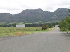
 The Bucketts Range is east of Gloucester |
|||||||
|
|||||||
|
|||||||
|
|||||||
|
|||||||
|
|
|||||||
Gloucester is a city in the east of the Australian state of New South Wales . It is located about 100 km north of Newcastle and about 60 km west of Taree , on the eastern edge of the Great Dividing Range . It is the administrative center of the Gloucester Shire Local Government Area . At the 2016 census, the city on the Gloucester River had 2,390 inhabitants.
History and economy
The Gloucester area was first toured in 1826 by Robert Dawson , chief agent of the Australian Agricultural Company (AA Company). The first settlers settled there in the 1830s. In 1855 the settlement of Gloucester was founded and initially served sheep farmers. But it soon became clear that this land was not ideal for sheep farming. Gloucester's main industries today are tourism, logging, cattle raising and coal mining. The timber industry has been dominant in the area since the end of the 19th century and is still an important branch of the economy, together with the cattle and dairy industries.
In 1876 gold was found in Copeland , a small settlement northwest of Gloucester. For example, because of the gold and red cedar trees ( Toona australis ) , Copeland became a sizable city with over 3,000 inhabitants. Since the end of the gold rush, however, its population has drastically decreased to a few hundred.
The Australian Agricultural Company had been awarded mining rights for an area of 2,000 km² between the Manning River and the Karuah River , which also included the Gloucester area. In the years 1856/57 the company employed land surveyors to survey a railway line from Port Stephens to Stroud and further north via Gloucester to the Manning River. After it became clear that the construction of this railway line was too difficult due to geographical conditions, coal mining was given up before it had really started.
In 1995, however, Gloucester Coal (formerly Stratford Coal ) began coal mining in Stratford , a village 12 km south of Gloucester. Since then, the company has expanded its mining operations across the district and appears to have acquired the rights of the AA Company.
traffic
The Bucketts Way connects Gloucester with the Pacific Highway north of Raymond Terrace and in Taree. In the city, the Thunderbolts Way branches off from Buckets Way and creates the connection via the Great Dividing Range to Nowendoc , Walcha and Armidale .
The North Coast Railway Line also runs through Gloucester.
Leisure and media
For most of the 20th century there were two cinemas on Church Street: The Star (closed in 1968) and the Majestic Theater (from the early 1920s to 1980). The building of the Majestic Theater still stands today and serves as a shopping center.
The Gloucester District weekly newspaper is called The Gloucester Advocate .
Web links
swell
- J. Webber & RF Wylie: Colliery Railways of the Australian Agricultural Company . Australian Railway Historical Society Bulletin No. 365 (March 1968) Volume XIX (New Series)
- Steve Parish: Australian Touring Atlas . Steve Parish Publishing, Archerfield QLD 2007, ISBN 978-1-74193-232-4 , p. 27
Individual evidence
- ↑ a b Australian Bureau of Statistics : Gloucester ( English ) In: 2016 Census QuickStats . June 27, 2017. Retrieved January 26, 2020.
