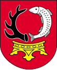
Gmina Czernikowo
| Gmina Czernikowo | ||
|---|---|---|

|
|
|
| Basic data | ||
| State : | Poland | |
| Voivodeship : | Kuyavian Pomeranian | |
| Powiat : | Toruński | |
| Geographic location : | 52 ° 57 ' N , 18 ° 56' E | |
| Residents : | see Gmina | |
| Postal code : | 87-640 | |
| Telephone code : | (+48) 54 | |
| License plate : | CTR | |
| Gmina | ||
| Gminatype: | Rural community | |
| Gmina structure: | 36 villages | |
| 17 school authorities | ||
| Surface: | 169.37 km² | |
| Residents: | 9081 (Jun. 30, 2019) |
|
| Population density : | 54 inhabitants / km² | |
| Community number ( GUS ): | 0415032 | |
| administration | ||
| Wójt : | Zdzisław Gawroński | |
| Address: | Słowackiego 12 87-640 Czernikowo |
|
| Website : | www.czernikowo.pl | |
The Gmina Czernikowo is a rural municipality in the powiat Toruński of the Kuyavian-Pomeranian Voivodeship in Poland . Their seat is the village of the same name ( German Czernikowo ) with about 2700 inhabitants.
structure
The rural community of Czernikowo includes 17 villages (German names until 1945) with a Schulzenamt:
|
|
Other localities in the municipality are:
|
|
|
Web links
- District of Czernikowo / Schwarzendorf (1939–1945)
- List of places in the district of Lipno / Leipe (West Pr.)
Footnotes
- ↑ population. Size and Structure by Territorial Division. As of June 30, 2019. Główny Urząd Statystyczny (GUS) (PDF files; 0.99 MiB), accessed December 24, 2019 .
- ↑ The Genealogical Place Directory
- ↑ a b c d See the Czernikowo / Schwarzendorf district , community renaming (1942)
