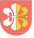
Gmina Ułęż
| Gmina Ułęż | ||
|---|---|---|

|
|
|
| Basic data | ||
| State : | Poland | |
| Voivodeship : | Lublin | |
| Powiat : | Rycki | |
| Geographic location : | 51 ° 36 ' N , 22 ° 7' E | |
| Residents : | see Gmina | |
| Postal code : | 08-504 | |
| Telephone code : | (+48) 81 | |
| License plate : | LRY | |
| Gmina | ||
| Gminatype: | Rural community | |
| Gmina structure: | 13 school authorities | |
| Surface: | 83.56 km² | |
| Residents: | 3157 (Jun. 30, 2019) |
|
| Population density : | 38 inhabitants / km² | |
| Community number ( GUS ): | 0616062 | |
| Address: | Ułęż 168 08-504 Ułęż |
|
The Gmina Ułęż is a rural community in the powiat Rycki of the Lublin Voivodeship in Poland .
structure
The following 13 villages with a Schulzenamt belong to the rural community of Ułęż :
- Białki Dolne
- Białki Górne
- Drążgów
- Korzeniów
- Lendo Ruskie
- Miłosze
- Podlodówka
- Sarny
- Sobieszyn
- Ułęż
- Wąwolnica
- Zosin
- Żabianka
Other places in the municipality are Brzozowa, Drewnik, Osmolice, Podlodów, Sarny and Stara Wólka.
Individual evidence
- ↑ population. Size and Structure by Territorial Division. As of June 30, 2019. Główny Urząd Statystyczny (GUS) (PDF files; 0.99 MiB), accessed December 24, 2019 .
