
Great South Bay
| Great South Bay | |
|---|---|
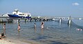
 East Patchogue Beach on Great South Bay |
|
| Waters | Atlantic Ocean |
| Land mass | long Island |
| Geographical location | 40 ° 41 ′ N , 73 ° 6 ′ W |
 |
|
| width | 11 km |
| length | 48 km |
| surface | 235 km² |
| Medium water depth | 1.3 m |
| Islands | Fire Islands, Captree Island, Cedar Island |
| Tributaries | Carmans River, Connetquot River |
The Great South Bay is a bay between Long Island and Fire Island in the US state of New York . The bay is part of the approximately 145-kilometer-long Long Island barrier beach system that extends from Coney Island in New York City to Southampton in east Long Island.
location
The Great South Bay has a length of about 48 kilometers parallel to the coast of Long Island, measures about 11 kilometers at its widest point and has an area of about 235 square kilometers, including the existing marshland . The mean water depth is 1.3 meters. The bay is a tidal body of water that is protected from the Atlantic Ocean by the offshore islands of Fire Island, Jones Beach Island and Captree Island . The bay is characterized by relatively flat areas and extensive salt marshes, with numerous small islands and shallows, especially on the southern side. Eight rivers flow into the bay, the most important of which are the Carmans River and the Connetquot River .
The western border of the Great South Bay is formed by the Gilgo Cut Boat Channel in Babylon , adjacent is the South Oyster Bay . The eastern border is the Smith Point Bridge in Brookhaven , which separates Great South Bay from Narrow Bay . There is a direct connection to the Atlantic Ocean via Fire Island Inlet , the passage between Fire Island and Jones Beach Island. The state parks Heckscher State Park and Connetquot River State Park on the Long Island side as well as Gilgo State Park , Captree State Park , and Robert Moses State Park on the offshore islands are located directly on Great South Bay.
The bay is accessed via the Robert Moses Causeway , which leads over the Great South Bay Bridge to Fire Island. The cities of Babylon, East Islip , East Patchogue and Brookhaven are located on Long Island on the Great South Bay.
Physical parameters
In the river mouths there is almost pure fresh water, in the mixing areas there is brackish water with a salt content between 21 and 30 per thousand. The highest salinity levels are measured in the channels to the open ocean, caused by the strong tidal currents. The bay has a maximum tidal range of about 1.3 meters. The water temperature can reach up to 29 ° C in summer, in winter the water can have temperatures around 0 ° C, in severe winters even down to −1 ° C. The freezing point of brackish water with a salt content of around 27 per thousand is 1.5 ° C. Due to the shallow depth, wind can mix the water down to the bottom, even in summer there is no pronounced temperature stratification in the bay. The mean exchange time of the water in the bay is between 50 and 96 days, the relatively high nutrient load can temporarily lead to plankton blooms in summer.
Emergence
The area was shaped by the runoff of glacial water during the Ice Age . The sediment in Great South Bay consists of sand and debris that was transported and deposited by the draining glacial water. These layers are covered by marine sandy sediments and silty sediments carried by the rivers into the bay. The system of the offshore islands, which consist mainly of sand, is subject to constant change due to currents, waves and wind. The Fire Island Inlet changed its location by about seven kilometers between 1825 and 1958 and numerous channels between the ocean and the bay have emerged and disappeared again over the years.
gallery
Bathing beach and boat launch on the bay side of Fire Island

View over Fire Island, ocean left, Great South Bay right

Sunset over the Great South Bay


Web links
Individual evidence
- ↑ a b Water Quality and Ecology of Great South Bay (Fire Island National Seashore Science Synthesis Paper) Technical Report NPS / NER / NRTR — 2005/019, National Park Service, US Department of the Interior (pdf; 1.0 MB) ( Memento of the original from September 15, 2012 in the Internet Archive ) Info: The archive link was automatically inserted and not yet checked. Please check the original and archive link according to the instructions and then remove this notice.
- ↑ a b U.S. Fish and Wildlife Service Conservation Library
- ^ Kana TW (1995) A mesoscale sediment budget for Long Island, New York. Marine Geology 126: 87-110