Gross Aubrig
| Gross Aubrig | ||
|---|---|---|
|
Gross Aubrig, north slope |
||
| height | 1695 m above sea level M. | |
| location | Northwest of Lake Wägital , Canton Schwyz | |
| Mountains | Etzel-Aubrig chain in the Schwyz Alps | |
| Dominance | 4.8 km → Fluebrig | |
| Notch height | 327 m ↓ Fläschlipass | |
| Coordinates | 709 792 / 218 864 | |
|
|
||
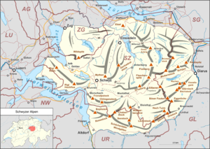
The Gross Aubrig (standard German equivalent of Grosser Auberg ) is a 1,695 meter high mountain in the Swiss canton of Schwyz . It is the highest peak in the mountain range in the Schwyz Alps that crosses from Etzel . The Gross Aubrig lies on the municipal boundary between Vorderthal and Innerthal . The north slope is dominated by rocks, while its south slope is cultivated in summer. About two kilometers to the west is the 1,642 meter high Chli Aubrig (Klein Aubrig).
Base and ascent
- From the Sattelegg -Passhöhe ( 1190 m ) in two and a half hours in an easy mountain hike according to literature (T1 or earlier B ) over the Alp Wildegg ( 1504 m ) to the summit.
- Over the north flank, only for experienced mountain hikers (T2 to T3 or EB ). From Vorderthal ( 731 m ) over Alp Dorlaui ( 1154 m ), then over steep meadows and rocks to the summit.
panorama
Panorama of a secondary peak of the Gross Aubrig. The Gross Aubrig can be seen at the two edges of the picture.
Map and literature
- Topographic national map of Switzerland 1: 25,000, sheet 1133, Lining plain (The Gross Aubrig is here on the southwestern edge of the map.)
- Willy Auf der Maur, Club Guide for Central Switzerland Prealps , published by the Swiss Alpine Club , 1996, ISBN 3-85902-146-X
Web links
Commons : Gross Aubrig - Collection of images, videos and audio files
- Tour reports and photos Gross Aubrig and Chli Aubrig


