Grupenhagen (Aerzen)
|
Groupenhagen
Spots Aerzen
|
|
|---|---|
| Coordinates: 52 ° 4 ′ 22 ″ N , 9 ° 13 ′ 27 ″ E | |
| Height : | 113 m |
| Area : | 6.44 km² |
| Residents : | 431 (December 1, 2019) |
| Population density : | 67 inhabitants / km² |
| Incorporation : | 1st January 1973 |
| Postal code : | 31855 |
| Area code : | 05154 |
|
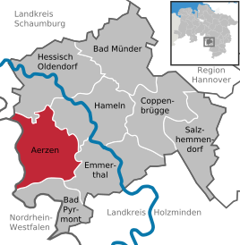
Location of the place Aerzen in the district of Hameln-Pyrmont
|
|
Grupenhagen is a district of the borough Aerzen in the Hamelin-Pyrmont district in Lower Saxony .
Geographical location
The place is about 10 km west of the district town of Hameln. To the south of the village lies the Lüningsberg , to the north lies the Hauben . The Beberbach flows through the town from west to east . Coming from the Goldbecker heights , the Goldbach flows into the Beberbach in the center of the village. The view to the west ends at the Hohe Asch .
history
On January 1, 1973, Grupenhagen was incorporated into the Aerzen district.
Coat of arms
The local coat of arms shows a green hedge with six red roses on a golden background that grows out of green soil.
With a decree of October 6, 1933, the rural community of Grupenhagen was granted permission to use the coat of arms by the Prussian State Ministry.
societies
The following associations are organized in Grupenhagen:
- DRK local association Grupenhagen / Multhöpen with the senior dance group
- Volunteer fire brigade together with the youth fire brigade and the music train of the Grupenhagen fire brigade
- Culture and local history association Grupenhagen
- Lower Saxony Comradeship Association eV Comradeship Grupenhagen
- Tennis friends Grupenhagen
- Association for culture, folk and homeland care together with the children's dance group
- Landfrauenverein Hameln-Pyrmont eV Local group Aerzen
traffic
Road traffic
Grupenhagen is located directly on the L432, which runs from Groß Berkel to Bösingfeld. The next motorway is the federal motorway 2 near Rehren.
literature
- Kurt Senke: Chronicle of the village of Grupenhagen - A simple look back, from the establishment of the village to the year 2000. 1st edition. Published by the Association for Culture, Folk and Homeland Care Grupenhagen, Grupenhagen 2000, DNB 1050377141 .
- Günter Graumann: In small offices and town halls - A handbook of communal self-administration in the Hameln-Pyrmont district - 1945 to 1972 . 1st edition. tape 1 . Published by the district of Hameln-Pyrmont, Hameln 1988, DNB 551529008 .
Individual evidence
- ^ Federal Statistical Office (ed.): Historical municipality directory for the Federal Republic of Germany. Name, border and key number changes for municipalities, counties and administrative districts from May 27, 1970 to December 31, 1982 . W. Kohlhammer, Stuttgart / Mainz 1983, ISBN 3-17-003263-1 , p. 194 .


