Selxen
|
Selxen
Spots Aerzen
Coordinates: 52 ° 3 ′ 41 ″ N , 9 ° 17 ′ 4 ″ E
|
|
|---|---|
| Height : | 84 m |
| Area : | 3.79 km² |
| Residents : | 108 (December 1, 2019) |
| Population density : | 28 inhabitants / km² |
| Incorporation : | 1st January 1973 |
| Postal code : | 31855 |
| Area code : | 05154 |
|
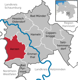
Location of Selxen in Aerzen
|
|
Selxen is a district of the borough Aerzen in the Hamelin-Pyrmont district in Lower Saxony .
Geographical location
The place is about 7 km southwest of the district town of Hameln . The Humme flows through the place from west to east .
history
Selxen was first mentioned in a document in 1288 under the name Selekessen .
On January 1, 1973 Selxen was incorporated into the Aerzen district.
Coat of arms
The local coat of arms shows five green oaks on a silver background; two down, three up.
The rural community of Selxen was granted permission by the Prussian State Ministry to use the coat of arms by decree of October 6, 1933.
Culture and sights
Since the year 2000, so-called bowling has been taking place in the village every year.
traffic

Road traffic
Selxen is located on Bundesstrasse 1 . The next motorway is the federal motorway 2 near Rehren.
Rail transport
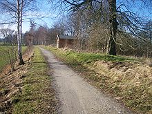
From 1897 to 1980, Selxen was connected to the local rail transport in the direction of Hameln and Bielefeld via a warehouse railway stop . Freight traffic was given up in 1985 and the route was dismantled. The route can now be used as a cycle path .
Air traffic
The nearest airports are Hannover-Langenhagen Airport and Paderborn-Lippstadt Airport .
literature
- Bianca Leisner, Friedrich Wilhelm Brockmann, Frank Bechmann, Wilhelm Siever: Chronicle of Selxen . 2nd Edition. Selxen 2007.
- Gunter Grumann: In small offices and town halls - A handbook of communal self-government in the Hameln-Pyrmont district - 1945 to 1972, Volume 1 . 1st edition. Published by the district of Hameln-Pyrmont, Hameln 1988.
Individual evidence
- ^ Federal Statistical Office (ed.): Historical municipality directory for the Federal Republic of Germany. Name, border and key number changes for municipalities, counties and administrative districts from May 27, 1970 to December 31, 1982 . W. Kohlhammer GmbH, Stuttgart and Mainz 1983, ISBN 3-17-003263-1 , p. 194 .

