Reinerbeck
|
Reinerbeck
Spots Aerzen
|
|
|---|---|
| Coordinates: 52 ° 2 ′ 10 " N , 9 ° 11 ′ 50" E | |
| Height : | 143 m above sea level NN |
| Area : | 8.15 km² |
| Residents : | 399 (Dec. 1, 2019) |
| Population density : | 49 inhabitants / km² |
| Incorporation : | 1st January 1973 |
| Postal code : | 31855 |
| Area code : | 05154 |
|
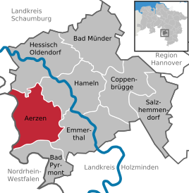
Location of Reinerbeck in Aerzen
|
|
Reiner Beck is a district of the borough Aerzen in the Hamelin-Pyrmont district in Lower Saxony .
Geographical location
Reinerbeck is located in the southwest of the Hameln-Pyrmont district in the Lipper Bergland . In the south of the Weserbergland Schaumburg-Hameln nature park , it is about 5 km west of the core town of Aerzen with the district town of Hameln 12 km away on the other side . The Ahornberg lies north of the village, the Lüningsberg a little to the east and the Saalberg to the south . The four rivers Schwarzbach, Eickerborn, Sprinterbach and Humme flow through the village. It can still be seen today how the course of the village is based on the Humme, which rises near Hummerbruch. The Schwarzbach, the "Black Beeke", runs through the Bruch, the oldest part of Reinerbeck. The Eickerborn rises between Dudenhausen and Uhlental in the Reinerbeck area and also flows into the Humme.
history
The first reliable evidence of a settlement near Reinerbeck comes from the year 1236. In a boundary description, there is talk of a "break". The Reinerbeck district of Bruch is coming from Reher , at the entrance to Reinerbeck. In the break, it is said, “the pancakes were only baked on one side”. That means: it was only built on one side of the street. Therefore the Bruch looks like a street village . Bruch was formerly called Bokenhusen, which translated means Buchenhausen.
The place name Reinerbeck is often translated as “pure Bach”, which is not entirely correct. Beck means Bach. It means water. Pure means to move quickly, to flow, to flow. Reinerbeck therefore means correctly translated: the fast moving, flowing water stream. Reinerbeck used to be called Staenke, in old records around 1404 it was also called Steenbecke or Staenke.
The ancient Teutons already settled there “wherever they cut a spring, a field or a forest”, wrote the Roman writer Tacitus . In his book “ Germania (Tacitus) ” he also described that the Germanic peoples built “each one individually and facing away from one another”. Exactly this type of construction can be found in Reinerbeck, from which it is concluded that Reinerbeck could already have been a Germanic settlement. On the other hand, there is certain evidence that Reinerbeck was Cheruskerland. Excavations in 1932 and 1938 unearthed barrows in the forests around Aerzen .
On January 1, 1973 Reinerbeck was incorporated into the Aerzen district.
Coat of arms
Reinerbeck's coat of arms - approved by the Prussian State Ministry in 1933 and drawn by a professor from Hanover - two brooks merge on a green field (meaning the Humme and the Schwarzbach) to form one river.
The streams and the river are represented by a silver band with black wavy lines.
Today, the confluence is hidden behind a bridge in a rather unspectacular manner, shortly after the Reinerbeck exit towards Aerzen.
societies
The following associations are organized in Reinerbeck:
- Bosselclub "Up de Heerstraat" Reinerbeck
- Reinerbeck volunteer fire brigade with youth fire brigade
- Bachelor club Reinerbeck from 1923 eV
- Lower Saxony Comradeship Association Reine
- Reinerbeck men's choir from 1898
- Reinerbeck stage
- Singing circle Reinerbeck
- SoVD - Reinerbeck local association
traffic
Road traffic
The district roads K36 from Alverdissen to Aerzen and the K56 from Reinerbeck to Reher lead through Reierbeck . The next motorway is the federal motorway 2 with a connection at Rehren 30.5 km to the north .
Air traffic
The nearest airports are Hannover-Langenhagen Airport and Paderborn-Lippstadt Airport .
literature
- Gunter Grumann: In small offices and town halls - A handbook of communal self-government in the Hameln-Pyrmont district - 1945 to 1972, Volume 1 . 1st edition. Published by the district of Hameln-Pyrmont, Hameln 1988.
Individual evidence
- ^ Federal Statistical Office (ed.): Historical municipality directory for the Federal Republic of Germany. Name, border and key number changes for municipalities, counties and administrative districts from May 27, 1970 to December 31, 1982 . W. Kohlhammer GmbH, Stuttgart and Mainz 1983, ISBN 3-17-003263-1 , p. 194 .


