
Gyeonguiseon
| Gyeongui Line | |||||||||||||||||||||||||||||||||||||||||||||||||||||||||||||||||||||||||||||||||||||||||||||||||||||||||||||||||||||||||||||||||||||||||||||||||||||||||||||||||||||||||||||||||||||||||||||||||||||||||||||||||||||||||||||||||||||||||||||||||||||||||||||||||||||||||||||||||||||||||
|---|---|---|---|---|---|---|---|---|---|---|---|---|---|---|---|---|---|---|---|---|---|---|---|---|---|---|---|---|---|---|---|---|---|---|---|---|---|---|---|---|---|---|---|---|---|---|---|---|---|---|---|---|---|---|---|---|---|---|---|---|---|---|---|---|---|---|---|---|---|---|---|---|---|---|---|---|---|---|---|---|---|---|---|---|---|---|---|---|---|---|---|---|---|---|---|---|---|---|---|---|---|---|---|---|---|---|---|---|---|---|---|---|---|---|---|---|---|---|---|---|---|---|---|---|---|---|---|---|---|---|---|---|---|---|---|---|---|---|---|---|---|---|---|---|---|---|---|---|---|---|---|---|---|---|---|---|---|---|---|---|---|---|---|---|---|---|---|---|---|---|---|---|---|---|---|---|---|---|---|---|---|---|---|---|---|---|---|---|---|---|---|---|---|---|---|---|---|---|---|---|---|---|---|---|---|---|---|---|---|---|---|---|---|---|---|---|---|---|---|---|---|---|---|---|---|---|---|---|---|---|---|---|---|---|---|---|---|---|---|---|---|---|---|---|---|---|---|---|---|---|---|---|---|---|---|---|---|---|---|---|---|---|---|---|---|---|---|---|---|---|---|---|---|---|---|---|---|---|---|---|---|
 | |||||||||||||||||||||||||||||||||||||||||||||||||||||||||||||||||||||||||||||||||||||||||||||||||||||||||||||||||||||||||||||||||||||||||||||||||||||||||||||||||||||||||||||||||||||||||||||||||||||||||||||||||||||||||||||||||||||||||||||||||||||||||||||||||||||||||||||||||||||||||
| Route number : | 303 ( KR ) | ||||||||||||||||||||||||||||||||||||||||||||||||||||||||||||||||||||||||||||||||||||||||||||||||||||||||||||||||||||||||||||||||||||||||||||||||||||||||||||||||||||||||||||||||||||||||||||||||||||||||||||||||||||||||||||||||||||||||||||||||||||||||||||||||||||||||||||||||||||||||
| Route length: | 56.1 km | ||||||||||||||||||||||||||||||||||||||||||||||||||||||||||||||||||||||||||||||||||||||||||||||||||||||||||||||||||||||||||||||||||||||||||||||||||||||||||||||||||||||||||||||||||||||||||||||||||||||||||||||||||||||||||||||||||||||||||||||||||||||||||||||||||||||||||||||||||||||||
| Gauge : | 1435 mm ( standard gauge ) | ||||||||||||||||||||||||||||||||||||||||||||||||||||||||||||||||||||||||||||||||||||||||||||||||||||||||||||||||||||||||||||||||||||||||||||||||||||||||||||||||||||||||||||||||||||||||||||||||||||||||||||||||||||||||||||||||||||||||||||||||||||||||||||||||||||||||||||||||||||||||
| Power system : |
(Seoul – Munsan) 25 kV / 60 Hz ~ |
||||||||||||||||||||||||||||||||||||||||||||||||||||||||||||||||||||||||||||||||||||||||||||||||||||||||||||||||||||||||||||||||||||||||||||||||||||||||||||||||||||||||||||||||||||||||||||||||||||||||||||||||||||||||||||||||||||||||||||||||||||||||||||||||||||||||||||||||||||||||
| Dual track : |
(Four-track) Digital Media City – Neunggok (two-track) Seoul – Digital Media City, Neunggok – Munsan |
||||||||||||||||||||||||||||||||||||||||||||||||||||||||||||||||||||||||||||||||||||||||||||||||||||||||||||||||||||||||||||||||||||||||||||||||||||||||||||||||||||||||||||||||||||||||||||||||||||||||||||||||||||||||||||||||||||||||||||||||||||||||||||||||||||||||||||||||||||||||
|
|||||||||||||||||||||||||||||||||||||||||||||||||||||||||||||||||||||||||||||||||||||||||||||||||||||||||||||||||||||||||||||||||||||||||||||||||||||||||||||||||||||||||||||||||||||||||||||||||||||||||||||||||||||||||||||||||||||||||||||||||||||||||||||||||||||||||||||||||||||||||
The Gyeongui Line (Korean 경의선 or 경의 본선: Gyeongui Main Line) is a railway line in South Korea that connects Seoul Station with the Dorasan . It is operated by the state-owned railway company, Korail , and there is a S-Bahn-like line between Seoul and Munsan , the Gyeongui-Jungang Line (Korean 경의 und). Before 1945 it was originally the Seoul- Sinuiju railway line and the name is derived from Gyeong from Gyeongseong ( Seoul ) and Ui from Sinuiju .
history
Before 1945
In 1896 the French company Fives-Lille received the concession from the government of the Joseon dynasty for the northern Hanseong ( Seoul ) -Uiju route. But the construction work did not start until 1902 due to lack of capital and only the substructure with about 10 km could be built without a rail layer. The Japanese army took over the concession for the building in preparation for the Russo-Japanese War . As a result, the military railroad was completed first. After the end of the war the line was rebuilt with the heavier rails, new tunnels and so on.
On April 3, 1906, it was fully opened with the completion of the bridges on the Cheongchon River. Sinuiju Station moved to its present location on November 1, 1911 and was connected to the Anfeng Line (Chinese 安奉 線, Shendan Line ). At the same time, the Shingishu line was split from the main line and the previous station became the Shingishu freight yard (Korean 신의주 하급 소역).
By 1920 the new line between Gyeongseong and Susaek was built and the former Yongsan – Susaek line was called the Yongsan Line . The international trains ran from Busan to Fengtian ( Shenyang ) via them in the 1930s and 1940s . Before 1945 it improved with the double-track line.
1945 to 2000
After the end of World War II, Korea was divided along the 38th parallel, so it was divided into three lines: Gyeongui Line, P'yŏngbu Line and P'yŏngŭi Line . The Red Army had blocked the line from Sariwon Station to the 38th parallel and the Yongsan – Toseong (Kaep'ung) line was operated in the area of the United States' armed forces . But the route in South Korea was shortened to the Seoul-Munsan interval after the end of the Korean War and became single-track again.
The RB trains (Korean 비둘기호 ) with steam locomotives (later diesel locomotives) ran for one hour until the 1990s. Since 1996, new diesel railcars were introduced, which were called the Tonggeun train (Korean 통근 열차 ).
In June 2000 there was an inter- Korean summit between Kim Jong-il and Kim Dae-jung , during which the reopening of the line was discussed.
Reconnection and electrification
After the first meeting of the heads of state of South and North Korea, the connection with the P'yŏngbu Line was planned. Until 2003 the line extended as follows:
| date | route | length |
|---|---|---|
| September 30, 2001 | Munsan-Imjingang | 6.0 km |
| April 11, 2002 | Imjingang-Dorasan | 3.8 km |
| December 31, 2002 | Dorasan - Demilitarized Zone |
On May 17, 2007, the test drive was carried out on the Musan – Kaesŏng route.
On April 1, 2004, the first electrification took place on the Seoul-Haengsin route for the opening of the KTX line. The overhead contact line on the Haengsin-Munsan line was installed by July 2009. Since July 1, 2009, electric multiple units have been running from Seoul to Munsan under the system of the Gyeongui S-Bahn line. So the Gyeongui Line in Seoul became inactive. However, a park was partially created around the inner-city Gyeongui line in Seoul, with some monuments.
gallery

Forest park along the former Gyeongui Line near Hongdae

Gyeongui Park at the junction with Ttaeng-ttaeng -Straße
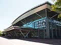
Dorasan Station, the last train station before North Korea
.jpg)
.jpg)
.jpg)

See also
literature
- Ministry of Railways (Japan) , pp. 483–485: 鉄 道 停車場 一 覧 昭和 12 年 10 月 1 日 現在 (The station list - as of October 1, 1937), Tokyo, 1937
Individual evidence
- ^ Korea. In: Viktor von Röll (ed.): Encyclopedia of the Railway System . 2nd Edition. Volume 6: Freight Transport Crises . Urban & Schwarzenberg, Berlin / Vienna 1914, pp 407 -412.
- ↑ 朝鮮 総 督府 官 報 (The Official Gazette of the Governor General of Korea), 明治 号 外, November 24, 1911 (Japanese)
- ↑ 百年 の 鉄 道 旅行 - The situation at the 38th parallel in Korea (Japanese)