Ayia Napa port
| Ayia Napa port | |||
|---|---|---|---|
| Data | |||
| UN / LOCODE | CY AYI | ||
| operator | several | ||
| Port type | Protective harbor | ||
| Total area of the port | 2 ha | ||
| Geographic information | |||
| place | Agia Napa | ||
| republic | Republic of Cyprus | ||
| Country | Republic of Cyprus | ||
| Ayia Napa Port (2010) | |||
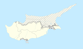
| Coordinates | 34 ° 58 '53 " N , 34 ° 0' 15" E | ||
|
|||
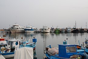
The port of Ayia Napa ( Greek Λιμανάκι Αγίας Νάπας ) is the easternmost protective port of the Republic of Cyprus . Since the EU expansion in 2004 , it has also been the easternmost port in the European Union .
geography
The port facilities are located one kilometer south of the historic city center of Ayia Napa in the Famagusta district on the Mediterranean . To the east rises Cape Greco , which bears important military installations and is partially designated as the Kavo Greko National Park . The port facilities include around two hectares of landing facilities and lake area. At the entrance to the harbor, two small lighthouses secure the access at night.
There are several parts of the port specially adapted for the respective purposes: Map with all coordinates: OSM | WikiMap![]()
| Port part | Port type | location | Quay length | depth | Equipment and use |
|---|---|---|---|---|---|
| Harbor, east basin | Harbor basin | ⊙ | 140 + 50 m, quay wall | k. A. | Landing jetty 50 × 5 m, 40 berths for fishing and passenger shipping |
| Harbor, West Basin | Harbor basin | ⊙ | 2 × 200 m, quay wall | k. A. | Landing jetty 15 × 3 m, 30 berths for leisure and excursion boats, restaurants |
| Outside area south | Lands | ⊙ | 120 m, sloping | k. A. | Mobile excavators, bollards , transhipment point for bulk goods |
| Pernera pier | Lands | ⊙ | no | k. A. | Landing jetty 7.5 × 2 m, slipway , fishing and recreational boating |
| Marina (under construction) | Marina | ⊙ | (Wharf and landing stage) | (2.5–6 m) | (380 water berths + 220 dry berths for recreational shipping, slip, 75 t travel lift, 20 shipyard cranes, catering) |
history
The first mention of the place dates from 1530. Hermits initially use the nearby karst caves until a monastery was built and in the vicinity the place developed with buildings in the style of the Venetian late Gothic ( Crusader Gothic ).
The port of Ayia Napa was a sleepy fishing spot until the 1974 military invasion of Turkey, Operation Atilla . After the Cyprus War it became the easternmost port of the Republic of Cyprus. It quickly gained tourist importance and was quickly expanded into the Mallorca Cyprus in the late 1970s .
Two breakwaters of 200 + 120 m in length have been in front of the port facilities since the 1970s , so that normally only slight waves and tidal range have to be expected in the port basins .
description
The eastern pier is reserved for commercial shipping, fishing boats, excursion boats and small cruise ships moor there. Small vehicles and yachts are mainly used in the western port basin . In addition to supply and disposal facilities, there are also leisure and gastronomic offers. The southern outer area is almost unprotected by the open sea and is used for handling bulk goods when required.
Two kilometers to the west, a little to the south of the Pernera district, there is another fishing pier with a small jetty and handling facilities.
Well separated, six kilometers to the west, the Ayia Napa Marina is being built with its own, adapted infrastructure. This serves exclusively for recreational shipping and tourist purposes. This is completely irrelevant for commercial large-scale shipping.
Web links
- Pan over the port facilities (Youtube Video 2:00 ")
Individual evidence
- ↑ Marina Ayia Napa . Retrieved February 20, 2019 .
- ↑ a b Description of the port at nissi-beach.com


