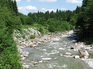
Half hammer
|
Halbammer ( Historically : Halbamper ) |
||
|
Halbammer below the bridge at Unternogg |
||
| Data | ||
| Water code | DE : 16412 | |
| location | Bavaria , Germany | |
| River system | Danube | |
| Drain over | Ammer → Amper → Isar → Danube → Black Sea | |
| origin | Confluence of Weißenbach and Bayerbach 47 ° 36 ′ 59 ″ N , 10 ° 57 ′ 16 ″ E |
|
| Source height | approx. 950 m above sea level NN | |
| muzzle | in the Ammer coordinates: 47 ° 39 '24 " N , 10 ° 59' 41" E 47 ° 39 '24 " N , 10 ° 59' 41" E |
|
| Mouth height | 800 m above sea level NN | |
| Height difference | approx. 150 m | |
| Bottom slope | approx. 24 ‰ | |
| length | 6.3 km | |
| Catchment area | 48.66 km² | |
| Discharge at the Unternogg gauge |
MNQ MQ MHQ HHQ (1999) |
330 l / s 1.66 m³ / s 47.7 m³ / s 126 m³ / s |
The Halbammer is a 6.3 km long left tributary of the Ammer in Upper Bavaria . It arises from the confluence of Weißenbach and Bayerbach in the Ammer Mountains .
geography
Spring streams
- Weissenbach
The Weißenbach rises on the Niederbleick (1,589 m). It initially flows in a south-easterly direction. At the Jagerstich it bends to the east and takes on the Klammbach. At 4.64 km, the Weißenbach is the longer and richer spring stream.
Its tributaries are:
- Müllergraben (left)
- Marrow ditch (right)
- Pfaffengraben (left)
- Gliegertsgraben (right)
- Klammbach (right)
- Bayerbach
The 4.27 km long Bayerbach rises at the foot of the Klammspitze (1,924 m). It flows northwards below the Mardersteig service hut and takes on the Eschenbach (moat). Directly on the border between Swabia and Upper Bavaria, it joins the Weißenbach to form the Halbammer.
course
After the streams have merged, the Halbammer flows north through the narrow Halbammerschlucht to Unterstogg. There it flows under the Ammer Canal and finally flows into the Ammer northwest of Altenau .
Tributaries
- Weißenbach (left source stream)
- Bayerbach (right source stream)
- Hengstbach (right)
- Rehgraben (left)
- Kohlgraben (left)
- Riebgraben (left)
- Trögellahnegraben (right)
- Leimbach (left)
Web links
Individual evidence
- ↑ Bayernviewer of the Bavarian Surveying Administration: Historical maps from the years 1817–1841 ( Memento of the original from August 8, 2014 in the Internet Archive ) Info: The archive link was inserted automatically and has not yet been checked. Please check the original and archive link according to the instructions and then remove this notice.
- ↑ a b List of creek and river areas in Bavaria - Isar river area, page 46 of the Bavarian State Office for the Environment, as of 2016 (PDF; 2.5 MB)
- ^ Bavarian flood news service
