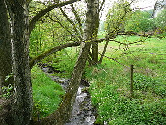
Hardenberger Bach
| Hardenberger Bach | ||
|
The Hardenberger Bach near Schmürsches ( Dönberg ) |
||
| Data | ||
| Water code | DE : 276962 | |
| location | Velbert , North Rhine-Westphalia , Germany | |
| River system | Rhine | |
| Drain over | Deilbach → Ruhr → Rhine → North Sea | |
| source | Near Wuppertal - Dönberg 51 ° 18 ′ 8 ″ N , 7 ° 9 ′ 16 ″ E |
|
| Source height | 270 m above sea level NN | |
| muzzle | In Velbert - Langenberg in den Deilbach Coordinates: 51 ° 21 ′ 11 ″ N , 7 ° 7 ′ 20 ″ E 51 ° 21 ′ 11 ″ N , 7 ° 7 ′ 20 ″ E |
|
| Mouth height | approx. 100 m above sea level NN | |
| Height difference | approx. 170 m | |
| Bottom slope | approx. 13 ‰ | |
| length | 13.2 km | |
| Catchment area | 35.033 km² | |
| Big cities | Wuppertal | |
| Medium-sized cities | Velbert | |
|
Tributaries and hydraulic structures
|
||||||||||||||||||||||||||||||||||||||||||||||||||||||||||||||||||||||||||||||||||||||||||||||||||||||||||||||||||||||||
The Hardenberger Bach is a flowing water that flows from Uellendahl to the north through Neviges , turns there to the east and flows into the Deilbach in Langenberg .
Surname
The brook is named after the Hardenberg rulership , through whose former rulership it flows.
Geographical location
Sights along the stream are:
- Hardenberg Castle
- Richrath Mill
- Town center Neviges
Backwaters
- Vettenbach
- Lünesbach
- Lohbach
- Kannebach
- Schmalenhofer Bach
- Krüdenscheider Bach
- Kimbecke
- Donkey Bach
- Dresberg Bach
- Hellerkampbach
- Brandenberger Bach
- Brullöhbach
See also
Individual evidence
- ^ German basic map 1: 5000
- ↑ Topographic map 1: 25,000
- ↑ a b Topographical Information Management, Cologne District Government, Department GEObasis NRW
Web links
- "Hardenberger Bach" nature reserve (W-020) in the specialist information system of the State Office for Nature, Environment and Consumer Protection in North Rhine-Westphalia
