Hermigua
| Hermigua municipality | ||
|---|---|---|
 Hermigua
|
||
| coat of arms | Map of the Canary Islands | |

|
|
|
| Basic data | ||
| Autonomous Community : | Canary Islands | |
| Province : | Santa Cruz de Tenerife | |
| Island: | La Gomera | |
| Coordinates | 28 ° 10 ′ N , 17 ° 11 ′ W | |
| Height : | 210 msnm | |
| Area : | 39.67 km² | |
| Residents : | 1,832 (Jan 1, 2019) | |
| Population density : | 46.18 inhabitants / km² | |
| Postal code : | E-38820 (Hermigua) E-38829 (Monteforte) E-38890 (El Curato) |
|
| Municipality number ( INE ): | 38021 | |
| administration | ||
| Mayor : | María Solveida Clemente (as of 2007) | |
| Address of the municipal administration: | C / El Curato, 109 38820 - Hermigua |
|
| Website : | www.villadehermigua.com | |
| Location of the municipality | ||

|
||
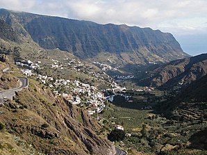
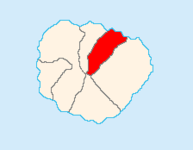
Hermigua is one of the six municipalities on the Canary Island of La Gomera . It is located in the northeast of the island. Hermigua is also the name of the administrative headquarters.
history
The Hermigua valley was already inhabited by the Gomeros ( old Canarians ). With them it belonged to the territory of the Mulagua. The origin of the municipality of Hermigua is in the 16th century, when the district of Valle Alto was created.
economy
Hermigua is considered to be the valley with the most water in La Gomera and is supplied all year round by the Rio del Cedro . That's why Hermigua lives mainly from agriculture in addition to little tourism. The mostly sunny side of the valley has been terraced to the highest level that can still be irrigated. Potatoes, papayas, bananas, cereals, legumes, pumpkins, beans and grapes are grown here.
The Garajonay National Park , which partly belongs to the municipality of Hermigua, is six kilometers east of the center.
Places of the community
The population figures in brackets are from 2007:
- Hermigua (433)
- Los Aceviños (81)
- Las Cabezadas (62)
- Callejon de Ordaiz (122)
- Las Casas (212)
- El Cedro (29)
- El Corralete (34)
- El Curato (110)
- El Estanquillo (136)
- Las Hoyetas (81)
- Ibo Alfaro (104)
- Llano Campos (94)
- Monteforte (59)
- Las Nuevitas (121)
- El Palmarejo (34)
- Piedra Romana (145)
- Las Poyatas (69)
- Santa Catalina (139)
- El Tabaibal (105)
Interesting places
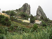
- The landmark of the place, the characteristic twin rock Roques de San Pedro, an old volcanic vent near Monteforte .
- Valle Alto was the name of the first settlement Hermigua, where the church Iglesia de Santo Domingo de Guzmán and the monastery of the same name, built between 1515 and 1520, are located. Baroque paintings, Moorish style elements and images of the Escuela popular can be seen in it.
- Later the new part of Valle Bajo was added with the Iglesia de Nuestra Señora de la Encarnación , created in 1650, with the Virgin sculpture by the sculptor Fernando Estévez .
- Los Telares Folklore Museum , which shows other handicrafts in addition to weaving
- The Cedro forest and the Nuestra Señora de Lurdes chapel
- The waterfall of El Chorro (highest waterfall of the island with more than 100 m height)
- The Majona Natural Park , east of Hermigua
- The former shipping point (with La Piscina - former banana washbasin and today's seawater swimming pool)
swell
- ↑ Cifras oficiales de población resultantes de la revisión del Padrón municipal a 1 de enero . Population statistics from the Instituto Nacional de Estadística (population update).
- ^ Instituto Canario de Estadística

