Herne Bay
| Herne Bay | ||
|---|---|---|
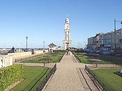
| Herne Bay - promenade with clock tower | ||
| Coordinates | 51 ° 22 ′ N , 1 ° 8 ′ E | |
| OS National Grid | TR177681 | |
|
|
||
| Residents | 38,563 (as of 2011) | |
| surface | 10.79 km² (4.17 mi² ) | |
| Population density | 3.574 / km² | |
| administration | ||
| Post town | HERNE BAY | |
| ZIP code section | CT6 | |
| prefix | 01227 | |
| Part of the country | England | |
| region | South East England | |
| Shire county | Kent | |
| District | Canterbury | |
| British Parliament | North Thanet | |
Herne Bay is a small town in Kent on the south coast of England with a population of around 35,000. It is located about eight miles from Canterbury and belongs to the City of Canterbury district .
history
The town developed from a small pub called The Ship and was initially a quarter for smugglers .
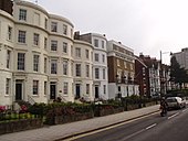
Herne Bay became a popular seaside resort in the Victorian era and large parts of the town are still Victorian today. The bay is misleading because there is no bay here.
Herne Bay had an iron pier more than 1000 meters long , the central part of which was destroyed in World War II for fear of invasion. It was rebuilt after the war, but then fell victim to a storm in 1978.
After 1990, a pier was built into the sea to protect against flooding , which includes a small harbor.
Herne Bay were during the Second World War bouncing bomb tested the 1943 Möhnetalsperre destroyed.
Town twinning
sons and daughters of the town
- Kevin Ayers (1944–2013), singer and musician
Personalities associated with the city
- Sir Barnes Wallis (1887–1979), engineer , was involved in the development of the rollerbomb, among other things


