Grauspitz
| Front gray tip | ||
|---|---|---|
|
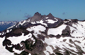
Vordergrauspitz (left) and Hintergrauspitz (right) from the east. |
||
| height | 2599 m above sea level M. | |
| location | Liechtenstein / Graubünden , Switzerland | |
| Mountains | Rätikon | |
| Dominance | 6.18 km → Schafberg | |
| Notch height | 353 m ↓ Salarueljoch | |
| Coordinates | 762 782 / 213 523 | |
|
|
||
| particularities | Liechtenstein's highest mountain | |
|
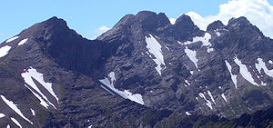
Hintergrauspitz (left) and Vordergrauspitz (right) from the northeast. |
||
At 2599 meters, the Grauspitz is the highest mountain in the Principality of Liechtenstein . The double summit of the Grauspitz consists of the Hintergrauspitz (2574 m), also called the Schwarzhorn , and the Vordergrauspitz (2599 m). It belongs to the Rätikon mountains and is on the border with the Swiss canton of Graubünden .
literature
- Manfred Hunziker: Ringelspitz / Arosa / Rätikon , Alpine Touren / Bündner Alpen , Verlag des SAC 2010, ISBN 978-3-85902-313-0 , p. 472 f.
Web links
Commons : Grauspitz - Collection of images, videos and audio files


