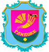
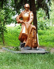
Hlyboke (Boryspil)
| Hlyboke (Boryspil) | ||
| Глибоке | ||

|
|
|
| Basic data | ||
|---|---|---|
| Oblast : | Kiev Oblast | |
| Rajon : | Boryspil district | |
| Height : | 105 m | |
| Area : | 4.265 km² | |
| Residents : | 2,107 (2001) | |
| Population density : | 494 inhabitants per km² | |
| Postcodes : | 08350 | |
| Area code : | +380 4595 | |
| Geographic location : | 50 ° 16 ' N , 30 ° 56' E | |
| KOATUU : | 3220882201 | |
| Administrative structure : | 2 villages | |
| Address: | вул. Центральна, буд. 25 08 350 с. Глибоке |
|
| Website : | Website of the district council | |
| Statistical information | ||
|
|
||
Hlyboke ( Ukrainian Глибоке ; Russian Глубокое Glubokoje ) is a village in the Ukrainian Oblast of Kiev with about 2100 inhabitants (2001).
The village, first mentioned in writing at the beginning of the 16th century, other sources mention the years 1629 and 1630, is the administrative center of the 65.473 km² district council of the same name in the center of Boryspil Rajon , to which the village of Horodyschtsche ( Городище , ⊙ ) is included belongs to about 310 inhabitants.
The village is 10 km south of the Boryspil district center and 45 km south-east of the Ukrainian capital Kiev . Territorial road T – 10–16 runs through the village .
Web links
Commons : Hlyboke - collection of images, videos and audio files
- Municipal Council website on rada.info (Ukrainian)
Individual evidence
- ↑ a b local website on the official website of the Verkhovna Rada ; accessed on May 24, 2018 (Ukrainian)
- ↑ history Hlyboke in the history of the towns and villages of the Ukrainian SSR ; accessed on May 24, 2018 (Ukrainian)
- ↑ The History of Hlyboke Village on the county council's official website; accessed on May 24, 2018 (Ukrainian)
- ^ Website of the district council on the official website of the Verkhovna Rada; accessed on May 24, 2018 (Ukrainian)


