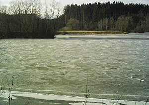
Rappenbach flood retention basin
| Rappenbach flood retention basin | |||||||||
|---|---|---|---|---|---|---|---|---|---|
|
|||||||||
|
|
|||||||||
| Coordinates | 47 ° 57 '34 " N , 10 ° 3' 30" E | ||||||||
| Data on the structure | |||||||||
| Construction time: | -1975 | ||||||||
| Height above foundation level : | 16.6 m | ||||||||
| Building volume: | 160 000 m³ | ||||||||
| Crown length: | 210 m | ||||||||
| Data on the reservoir | |||||||||
| Water surface | 40 ha | ||||||||
| Storage space | 1 780 000 m³ | ||||||||
| Total storage space : | 1 490 000 m³ | ||||||||
| Design flood : | 95 m³ / s | ||||||||
The Rappenbach flood retention basin of the Rottal Water and Soil Association is used for flood protection and local recreation. The flood retention basin is located near Haslach , a district of the municipality of Rot an der Rot in Baden-Württemberg .
In the permanently dammed basin with two long inlet bays, the left Rappenbach and the right Schmiddis unite to form the Haslach , which flows approximately northwards and which drains between Rot an der Rot and Zell into the Rot and then on to the Danube .
The earth dam, which is a little over a kilometer south-southeast of the town of Haslach, is 16.6 m high and 210 m long on the crown; it constantly accumulates 290,000 m³ of water on an area of 10.8 ha. In the event of flooding, it can hold back an additional 1,490,000 m³. The structure was completed in 1975.
See also
Individual evidence
- ↑ a b c d Building data according to the dam layer on: State Institute for the Environment Baden-Württemberg (LUBW) ( notes )
- ↑ Permanent damming area after the still waters layer on: State Institute for the Environment Baden-Württemberg (LUBW) ( information )

