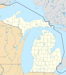
Howell (Michigan)
| Howell | ||
|---|---|---|
|
Location in Michigan
|
||
| Basic data | ||
| State : | United States | |
| State : | Michigan | |
| County : | Livingston County | |
| Coordinates : | 42 ° 37 ′ N , 83 ° 56 ′ W | |
| Time zone : | Eastern ( UTC − 5 / −4 ) | |
| Residents : | 9,232 (as of: 2000) | |
| Population density : | 870.9 inhabitants per km 2 | |
| Area : | 11.2 km 2 (approx. 4 mi 2 ) of which 10.6 km 2 (approx. 4 mi 2 ) is land |
|
| Height : | 285 m | |
| Postcodes : | 48800-48899 | |
| Area code : | +1 587 | |
| FIPS : | 26-39540 | |
| GNIS ID : | 0628717 | |
| Website : | www.cityofhowell.org | |
Howell is a city in the American state of Michigan , about 80 km west of downtown Detroit . Howell is in Livingston County , the administrative seat of which is the city. The city has a good 9,000 inhabitants. (As of the 2000 census .) Howell is located around Thompson Lake, which takes up about 5% of the city's area of 11 km². The city is surrounded by Howell Township .
history
The first settlements by settlers of European origin in what is now the city of Howell date back to 1834, the names of the settler families of George T. Sage and James Sage, David Austin and John D. Pinckney are known. (The namesake of Pinckney , 18 km south of Howell, comes from the latter's family.) In 1835 Flavius JB Crane and Edward Brooks parceled out the settlement, which was first called Livingston Center because of its location in the middle of County Livingston . Crane, who became Howell's first postmaster in 1836 , renamed the settlement after his friend Thomas Howell. In 1863 Howell was given village status .
Forestry and sawmills owned by the McPherson family were the mainstay of Howell's economy until the 1860s . After most of the forests in the area were cleared , dairy farming developed in the cleared areas , and Howell became one of the largest centers for Holstein cattle rearing in the United States. 1914 Howell received the status of a city ( City ).
In 1987 the historic city center of Howell was added to the National Register of Historic Places (NRHP), making it a listed building. In addition, there are a number of individual buildings in the NRHP register, including the railway station "Ann Arbor Railway Station" and the courthouse designed by Detroit architect Albert E. French for the county , the "Livingston County Courthouse", which was completed in 1890. The two and a half story courthouse contains some of the original Victorian furnishings .
Web links
- Official Website of Howell (English)
- Collection of historical documents on Howell and Livingston County (English)
- History of Howell (abstract on the city website)
- Walk through Time - official city history from 1986. (Published on the occasion of the city's 150th anniversary, English .; PDF file; 2.73 MB)
Individual evidence
- ^ A b Walter Romig: Michigan Place Names . Wayne State University Press, Detroit 1986, ISBN 081431838X , p. 275.
- ^ Federal Writers' Project : Michigan: A Guide to the Wolverine State . Oxford University Press, New York 1941, p. 418. (Reprint published by Somerset Publishers, St. Clair Shores MI 1973, ISBN 0403021723. )
- ↑ MICHIGAN - Livingston County on the National Register of Historic Places: Ann Arbor Railway Station (NRHP listing 1971, # 71000405), Livingston County Courthouse (NRHP listing 1976, # 76001031), Frank J. Hecox House, also House of Seven Gables named (NRHP recording 1994, # 94000745), John H. Galloway and Martha Durfee House (NRHP recording 2006, # 06001030) (Retrieved July 20, 2009.)
- ^ Laura R. Ashlee: Traveling through time: a Guide to Michigan's Historical Markers . University of Michigan Press, Ann Arbor 2005, ISBN 0472030663 , pp. 257-258.
