Interstate 35W Mississippi River Bridge
Coordinates: 44 ° 58 ′ 44 ″ N , 93 ° 14 ′ 42 ″ W.
|
|
||
|---|---|---|
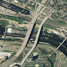
| May 2006, viewed from the north side | ||
| use | eight lanes of Interstate 35W | |
| Crossing of | Mississippi River | |
| place | Minneapolis , Minnesota | |
| Entertained by | Minnesota Department of Transportation | |
| Building number | 9340 | |
| construction | Steel truss bridge | |
| overall length | 581 m | |
| width | 33 m | |
| Longest span | 140 m | |
| Clear height | 19.5 m | |
| opening | November 1967 | |
| closure | August 1, 2007 (collapse) | |
| location | ||
|
|
||
| Location in the city | ||
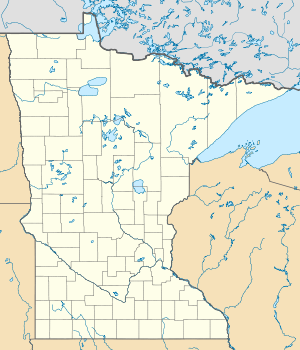
| Location of the collapsed bridge | ||
The Interstate 35W Mississippi River Bridge was a steel truss bridge in Minneapolis , United States . It was built in 1967 and ran along the Interstate Highway 35W across the Mississippi . It connected the districts of Downtown East and Marcy-Holmes in Minneapolis .
The bridge was 581 m long, 33 m wide, 19.5 m high above the river, had four lanes in each direction and was crossed by an average of 141,000 vehicles per day, according to the Minnesota Department of Transportation.
It collapsed on August 1, 2007 during rush hour. The accident killed 13 people, the last victim could not be recovered until August 20. In the months after the accident, the new construction of the ten-lane St. Anthony Falls (35W) Bridge , which was opened on September 18, 2008, was built on the same site .
Historical background
The bridge was built in an area of east Minneapolis that had been well developed for more than 160 years. The first commercial use began in 1848 a mile north of the bridge at Saint-Anthony Falls and spread from there. Over time, therefore, a section of the river developed which is characterized by bridges, locks and dams.
Progress, however, was not easy; the Hennepin Island Tunnel collapsed in 1869, necessitating the concreting of a weir at the Saint Anthony Falls. In 1878 there was a momentous explosion at the Washburn "A" Mill .
The area surrounding the southern abutment of the bridge is eight hectares that was used in the 90 years before the bridge was built by the Minneapolis City Gasworks, which operated a coal gasification plant here. Minnegasco, which ultimately became part of CenterPoint Energy , had the plant demolished in the 1960s because the use of natural gas made coal gasification unprofitable. Half of the area was sold to the Continental Oil Co., which stored and processed oil products on the site for another 20 years.
The long industrial use resulted in the contamination of the soil under the bridge with toxic substances. Years of litigation over the cost of clearing up these contaminated sites lasted until 1991 and 15,000 tons of contaminated soil were removed from the area below and next to the bridge. The cost of disposing amounted to between 1993 and 1998 a total of around 30 million US dollars .
Construction and maintenance
The two reinforced concrete main pillars of the bridge were arranged on the banks of the 119 m wide river. The superstructure consisted of a 323 m long haunched truss construction with a maximum span of 139 m. The bridge was an important road link on Interstate 35W. Because of the cold Minnesota winters, the bridge had had a de-icing system since 1999. Potassium acetate was sprayed onto the road surface at temperatures that allowed ice to form on the road surface. A similar system was later installed on the Brooklyn Bridge in New York City .
In September 1991, the two right, north-facing lanes were closed for maintenance work, three years later the right, north-facing lane was temporarily closed to investigate the condition of the bridge. In 1998 the street lighting was repaired.
collapse
On Wednesday, August 1, 2007, the bridge partially collapsed during rush hour at 6:05 p.m. local time. As a result, at least 50 vehicles, their occupants and several construction workers fell either into the river bed or onto the banks. A total of 13 people were killed. Several vehicles caught fire. Part of the bridge collapsed on freight wagons standing under the bridge, crushing three railway wagons with plastic granulate and damaging a fourth. The tracks belong to an industrial connection of the Minnesota Commercial Railway .
According to the investigation report by the National Transportation Safety Board, the cause of the collapse was a design error by the engineers who incorrectly dimensioned the gusset plates of the steel girders. The inadequate monitoring by the supervisory authorities is also criticized in the final report. A few weeks before the collapse, construction work began in the area of the bridge structure. Therefore, traffic management was restricted to two lanes in each direction. Shortly before the incident, the Minnesota Department of Transportation (Mn / DOT) announced that traffic would be restricted to one lane in each direction on the late evenings of July 31 and August 1.
2001 Mn / DOT report
In this report it was revealed that the bridge's designers had not correctly proven when the first fatigue fractures would occur in the steel framework. The weak point was the welded joints that connected the individual truss rods. It was also criticized that the entire bridge could collapse in the event of a fatigue failure of one of these connections. The result of the investigation was that failure of the components was not to be expected and an inspection every 6 months would be sufficient.
The Minnesota State Highway 280 has been designated as the official alternative route, which is why it has been converted into a freeway in sections .
See also
- List of bridge collapses
- Silver Bridge , a former bridge over the Ohio River that collapsed in 1967 under similar conditions
literature
- Mary Charlotte Costello: Climbing the Mississippi River Bridge by Bridge. Volume 2: Minnesota. MC Costello, Davenport IA 2002, ISBN 0-9644518-2-4 .
Web links
- Aerial photographs of the bridge before the collapse (English)
- Minneapolis Bridge Collaps Dossier on Minnesota Public Radio
- Possible design flaw ( memento of March 24, 2008 in the Internet Archive ) - Startribune.com, July 2008
Individual evidence
- ^ Bridge was rated 'structurally deficient' in 2005 , Star Tribune. August 2, 2007. Archived from the original on October 24, 2007.
- ↑ Traffic Volume Maps (Annual Average Daily Traffic) (PDF; 2.6 MB) Minnesota Department of Transportation. 2005. Accessed August 1, 2007 ( PDF ).
- ↑ a b Meersman, Tom. Star Tribune : Citizens board OKs NSP plan to burn tainted soil . News section; Page 5B. April 28, 1993.
- ↑ a b c Rebuffoni, Dean. Star Tribune : Old plant site spawns environmental, legal mess. Now the questions is: Who will pay for riverfront cleanup? Section: News; Page 1B.
- ↑ Meersman, Tom. Star Tribune : Minnegasco has a legacy of waste - to burn . Section: News; Page 1B. March 23, 1993
- ↑ Lucile M. Kane: The Falls of St. Anthony. The Waterfall that built Minneapolis. Minnesota Historical Society Press, St. Paul MN 1987, ISBN 0-87351-205-7 .
- ↑ Meersman, Tom. Star Tribune : Minnegasco starts cleaning up riverside waste today . News section; Page 3B. July 7, 1993.
- ↑ Meersman, Tom. Star Tribune : The environment. Digging up a new riverside. Minnegasco's cleanup of contaminants along the Mississippi will clear the way for a north-south parkway link . Section: News; Page 3B. March 21, 1996.
- ↑ Ison, Chris. Star Tribune New pollution-agency chief was at center of cleanup flap . News section; Page 1B. March 21, 1999.
- ↑ Ahern, Don. (September 16, 1991) St. Paul Pioneer Press Schools are open again and so are most metro roads. Section: Metro; Page 6A
- ↑ Ahern, Don. (September 26, 1994) St. Paul Pioneer Press Forget the calendar; Road projects show season hasn't changed. Section: Metro; Page 1B
- ^ St. Paul Pioneer Press (October 21, 1998) Metro / Region briefing. I-35W lanes closed today. Section: Local; Page 3D
- ↑ a b I-35W bridge collapses ( Memento of the original from August 10, 2007 in the Internet Archive ) Info: The archive link was inserted automatically and has not yet been checked. Please check the original and archive link according to the instructions and then remove this notice. , Star Tribune , August 1, 2007
- ↑ 35W bridge over Mississippi collapsed , 5 EYEWITNESS NEWS. August 1, 2007.
- ↑ Trains News Wire: Minnesota Commercial line blocked by Minneapolis bridge collapse Unavailable March 16, 2018.
- ^ The report of the "Star Tribune, Minneapolis", final report ( Memento of February 7, 2009 in the Internet Archive )
- ↑ 35W Bridge Collapses , KARE11. August 1st, 2007. Archived from the original on December 8th, 2012 Info: The archive link was inserted automatically and has not yet been checked. Please check the original and archive link according to the instructions and then remove this notice. . Retrieved August 1, 2007.
- ^ Fatigue Evaluation of the Deck Truss of Bridge 9340 (PDF; 2.4 MB), Minnesota Department of Transportation, Report # MN / RC-2001-10, March 2001, accessed from the Minnesota Local Road Research Board website
|
Upstream Stone Arch Bridge |
Crossing the Mississippi River |
Downriver Tenth Avenue Bridge |


