Isopache
In the geosciences, isopache is a line ( isoline ) of the same thickness of a geological layer in the map display of an isopach map .
Use and meaning of Isopach maps
Like contour lines (isohypses), isopaches are compiled as lines in isopache maps . It is only through this cartographic compilation that isopaches are useful for evaluation.
The representation of isopaches in maps is of particular interest for economically usable formations and in research projects . Examples include the representation of
- Deposits or areas of hope ,
- extensive sediment layers, for example on ocean floors
- Bulk raw materials like coal and salt
- special geological horizons
- Ice thicknesses in glaciers
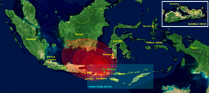
- Thickness distributions of volcanic ashes during volcanic eruptions.
Other representations can also be derived from Isopach maps, such as the representation of thickness as a color code.
Production of Isopach cards
The existing data (data from literature, own investigations) of the geological body to be displayed, such as the thickness of a glacier at certain points or the thickness of a coal layer in different stretches of a mine, are entered in a map view. The thickness gradation is then interpolated between the individual data . In simple cases this can be done, for example, by dividing the distance of the data points by the difference in thickness between two data points in order to determine the increase in thickness per unit distance. Depending on the desired step size, that point can be determined between the two points which corresponds to a thickness to be displayed.
Example: An isopache map of a glacier should be drawn in increments of isopaches of 50 m. At point A the thickness of the glacier ice is 100 m, at point B it is 200 m, so the difference is 100 m. The two points are 1,000 m apart. The calculation results in a ten meter difference in thickness over a distance of 100 m between the points. A difference in thickness of 50 m is therefore equal to a distance that corresponds to 500 m on the map.
After determining all the necessary power points, these are connected by isopaches.
Data bases of Isopach maps
The basis of the determination of isopaches is normally point or line shaped and, more rarely, flat thickness data of the geological body to be displayed.
Point-shaped data on thicknesses mainly come from
- geological outcrops such as rock faces, quarries, road cuts and mines
-
Holes of various types like
- Exploration drilling
- scientific drilling
- Continental deep drilling programs such as the Continental Deep Drilling Program of the Federal Republic of Germany (KTB) and the International Continental Scientific Drilling Program (ICDP)
- marine deep drilling such as the international Ocean Drilling Program (ODP) and the Deep Sea Drilling Project (DSDP)
Linear data about thicknesses can be obtained through
- systematically applied seismic profiles
- Georadar
- Gravimetry and accompanying models for the vertical and horizontal course of the density
Areal thickness data are obtained from
- Surface mapping
-
geophysical mapping methods such as
- Ultrasonic measurements
- geoelectric mapping
- geomagnetic mapping
- seismic mapping with sufficient data density
literature
- Hohl, Rudolf (ed.): The history of the development of the earth. 6th edition, Werner Dausien Verlag, Hanau 1985, 703 pp. ISBN 3-7684-6526-8

