Jablanica (mountains)
| Јабланица / Jablanica | ||
|---|---|---|
|
Vevčani Lake near the village of Gorna Belica in the Struga municipality , in the background the 2257 meter high Black Stone . |
||
| Highest peak | Black stone ( 2257 m. I. J. ) | |
| location | North Macedonia / Albania | |
|
|
||
| Coordinates | 41 ° 17 ′ N , 20 ° 32 ′ E | |
| particularities | National park | |
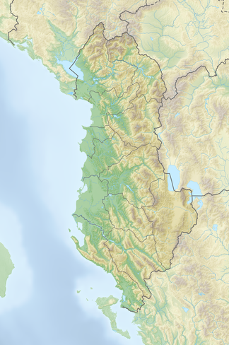
The Jablanica ( Macedonian Јабланица ; Albanian Jabllanica or Jabllanicë ) is a mountain range in Albania and North Macedonia . It extends on the border in a north-south direction northwest of Lake Ohrid to Debar . It is around 50 kilometers long and reaches mountain heights of up to over 2000 m. i. J. The highest mountain is the Black Stone ( Macedonian Црн Камен Crn Kamen ; Albanian Gur i Zi ) roughly in the center of the mountain. This mountain is 2257 m. i. J. high. Both states have around half of the mountains. The biggest cities near the mountain are Librazhd in Albania and Struga in Macedonia.
In the east the mountains descend to the valley of the Black Drin and Lake Ohrid , in the west the mountain range of the Shebenik rises after a small valley , which is almost the same height.
The Albanian side of the mountain range has been protected as a national park since 2008 , together with the Shebenik mountain, which lies a little to the west .
Web links
Individual evidence
- ↑ Vendim No. 640 (May 21, 2008): Për shpalljen “Park kombëtar” të ekosistemit natyror shebenik-Jabllanicë. (PDF) Archived from the original on December 10, 2014 ; accessed on January 16, 2016 .


