Radolišta
| Radolišta Радолишта Ladorisht |
||||
|---|---|---|---|---|
|
||||
| Basic data | ||||
| Region : | southwest | |||
| Municipality : | Struga | |||
| Coordinates : | 41 ° 9 ' N , 20 ° 37' E | |||
| Height : | 745 m. i. J. | |||
| Residents : | 4,821 (2019) | |||
| License plate : | SU | |||
| Structure and administration | ||||
| Website : | ||||


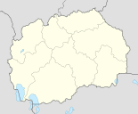
Radolišta ( Macedonian Радолишта ; Albanian Ladorisht or Ladorishti ) is a village in the municipality of Struga , in the southwest of North Macedonia .
geography
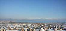
The village is located near the state border with Albania on the eastern slope of the Jablanica Mountains on the Macedonian side of the ridge. A small stream flows through the village, which flows into Lake Ohrid after 2.5 kilometers . Radolišta is 5 kilometers from Struga and 9 kilometers from the Qafë Thana border crossing . When the weather is nice, the upper village offers a view of Ohrid , Struga and the lake.
Neighborhoods are Zagračani in the north, Struga in the east, Kališta in the southeast and Frangovo in the south .
population
According to the 2019 census, the majority of the 4821 inhabitants consider themselves Albanians and live in 825 households. The local dialect is Tuscan . Most of the residents profess Sunni Islam .
Villagescape
The village is very densely built up. In addition to many multi-family houses, which have mainly been built in recent years, there are old Balkan buildings. In the village there are mosques and the primary school "Ajdar Dushi", where Albanian is taught. On the outskirts of the village is the place Fjerišta , which is a suburb of Radolišta.
On October 28, 1944 , German military units massacred unarmed residents of the village . A memorial and a cemetery renovated in 2009 commemorate this.
economy
Today the population of the village is mainly engaged in trade and commerce. Agriculture used to be the main industry. But since the fall of Yugoslavia, the fields and vineyards have been fallow. Only a few smaller farms plant wheat and corn. As in every village in the Struga plain, above the village there are many old chestnut trees from the 19th and 20th centuries that have not yet dried up. Some of the vines are mostly cultivated by elderly people. The reason the fields lie fallow is that the village stream has not had any water for several years. Another one that the village is affected by rural exodus.
At the Dorfbach there are some empty flour mills that are now almost in ruins. This is mainly due to the lack of use and the drying up of the stream.
archeology
To the east of the village, in the direction of Europastraße, there are ancient Illyrian princely graves from the 8th – 4th centuries. Century BC The tombs contain imported luxury goods such as precious metal vessels and ceramics. The royal tombs were built by two royal dynasties.
Above the village there is a very old church, which the inhabitants call Kisha ilire , “Illyrian Church”. It probably comes from the pre-Slavic era and thus from the Byzantine period.
Personalities
- Ibrahim Abedini , writer, storyteller and book author
- Xhevit Hoxha (1942–2015), teacher and swimmer
- Lebit Murtishi (* 1955), poet
- Selami Kolonja (* 1970), singer
Web links
Individual evidence
- ^ Report of the Macedonian TV station ALSAT
- ↑ Forms of political organization in pre-Roman southern Illyria by Peter Siewert, pp. 59 & 60 ( Memento of September 28, 2007 in the Internet Archive ) (PDF; 128 kB)


