Dolno Tateši
| Dolno Tateši Долно Татеши Tatesh i Poshtëm |
||||
|---|---|---|---|---|
|
||||
| Basic data | ||||
| Region : | southwest | |||
| Municipality : | Struga | |||
| Coordinates : | 41 ° 16 ' N , 20 ° 41' E | |||
| Height : | 725 m. i. J. | |||
| License plate : | SU | |||
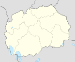
Dolno Tateši ( Macedonian Долно Татеши ; Albanian Tatesh / ii Poshtëm ) is a village in the Opština Struga in southwestern North Macedonia .
location
The place is located about 10 kilometers from Lake Ohrid , the main town Struga is nine kilometers south of the town. Dolno Tateši is located on the northern edge of the valley created by the Drin River, which leaves Lake Ohrid in Struga. A wooded mountainous area begins about two kilometers to the northeast, and this is where the main streams of the district arise. The southern foreland is relatively flat and is used intensively for agriculture. The numerous fields are arranged in very narrow, barely 10 meters wide strips, they are accessed by a few dirt roads on the narrow side. Since the state independence of Macedonia , the village has developed noticeably, the western location already borders on the neighboring town of Gorno Tateši .
Attractions
The attraction of the place is a mosque with a towering minaret , the place is mostly inhabited by Muslim Albanians. The mosque is in the center of the village, in front of the church there is also a sebilj on the village square - the traditional market fountain in Arab countries.
In Dolno Tateši there is only one primary school up to fourth grade. From the fifth grade onwards, students go to school in Tatesh i eperm.
Individual evidence
- ↑ Russian General Staff Map of Albania / Yugoslavia TK50, sheet II-34-102-1 - СТРЧГА, 1984 edition ( Memento from January 13, 2014 in the Internet Archive )
- ↑ a b aerial photo evaluation (orthophoto on Google Earth)


