Frangovo
| Frangovo Франгово Frëngova |
||||
|---|---|---|---|---|
|
||||
| Basic data | ||||
| Region : | southwest | |||
| Municipality : | Struga | |||
| Coordinates : | 41 ° 9 ' N , 20 ° 37' E | |||
| Height : | 781 m. i. J. | |||
| Residents : | 1,178 (2002) | |||
| Telephone code : | (+389) 046 | |||
| Postal code : | 6330 | |||
| License plate : | SU | |||
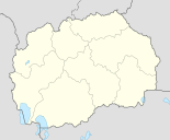
Frangovo ( Macedonian Франгово , Albanian Frëngovë / Frëngova ) is a small village in the municipality of Struga in southwestern North Macedonia .
geography
The village is a little off the Struga plain, in a valley where a small stream flows. Frangovo is surrounded by many forests and is 6 kilometers from the border with Albania . Neighboring villages are Radolišta and Fjerišta (suburb of Frangovo) in the north, Kališta in the east and Mali Vlaj in the south . The view of Lake Ohrid remains hidden because of a mountain.
Population, language and religion
According to the 2002 census, the population is made up as follows:
Economy and Infrastructure
The inhabitants are busy in a variety of ways. Part of the population works in forestry , another part in agriculture , but the greater part is employed in the west and in the neighboring town of Struga (industry and trade).
The village is connected by the European road E852 from Ohrid to Struga (it continues to Albania, where it ends in Tirana ). The airport Ohrid is only 15 kilometers away. The road is the Pan-European Transport Corridor VIII .


