Delogoždi
| Delogoždi Делогожди Dollogozhda |
||||
|---|---|---|---|---|
|
||||
| Basic data | ||||
| Region : | southwest | |||
| Municipality : | Struga | |||
| Coordinates : | 41 ° 15 ' N , 20 ° 43' E | |||
| Height : | 790 m. i. J. | |||
| Residents : | 3,865 (2019) | |||
| Telephone code : | (+389) 046 | |||
| Postal code : | 6330 | |||
| License plate : | SU | |||
| Structure and administration | ||||
| Structure : | no | |||
| Mayor : | no mayor's office | |||
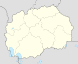
Delogoždi ( Macedonian Делогожди ; Albanian Dollogozhda or Dollogozhdë ) is a village in the Opština Struga in southwestern North Macedonia . Until 2004 Delogoždi formed the main town of the Opština of the same name , which also included other neighboring villages. During the reforms in the administrative system of Macedonia, however, it was attached to that of the city of Struga .
geography
Delogoždi is located at the transition between the northern part of the Struga plain and the southern part of the Karaorman Mountains at an average of 800 meters above sea level. The old village center is right in front of the entrance to a stream valley that stretches to the north. Immediately to the west of the entrance rises the wooded southern slope of the Karaorman, while to the east there is a small rocky outcrop made of limestone and where there are maquis . The stream flowing out of the valley divides the village into a western and an eastern half and flows into the Black Drin after a few kilometers in the southwest .
To the west of the village is the Terra Rossa plain , which the people call Kuqlina - from Albanian kuq : "red". Among other things, grain is grown there, but mostly vines predominate. The grapes grown there have a very sweet taste.
On the Kuqlina is the dried up stream of the Vromi , which in the past often caused landslides . However, since 1950 the risk of floods and landslides has been continuously reduced. Among other things, a canal lined with chestnut and pine trees was built so that the Vromi only carries water in winter. At the same time, the planting of trees on the southern slope of the Karaorman Mountains began, which also led to a reduction in the risk of landslides.
The Ohrid Lake is about ten kilometers south.
Neighboring villages are Poum (5 km) in the north, Džepin (1.7 km) and Korošišta (2.7 km) in the east, Livada (3.3 km) in the south and Dolno Tateši (3.6 km) and Gorno in the west Tateši (4.9 km).
population
According to the 2019 census, Delogoždi had 3,827 residents who lived in 682 households. This made an average of five people per household. The ethnic structure was almost homogeneous : of the total population, 3,813 were Albanians . The other 14 came from other ethnic groups. The Albanians also gave Islam as their religion . They only speak the Gegic dialect of Albanian .
history
In 1873 the village had 25 families with 65 Muslim men. In 1900 there were 730 registered residents, all of whom were Muslim Albanians.
economy
The main branches of economy include agriculture, livestock, dairy and cheese industries and beekeeping. However, a large part of the population is in the diaspora and earns its income there. The unemployment rate is very high; few work in the remaining economic sectors, trade and industry, which are mainly located in the city of Struga . Some employees also make a living from tourism and the hospitality industry.
Between 1960 and before the collapse of Yugoslavia , the village was mainly known for growing peppers and tobacco . However, after the irrigation system was no longer serviced, less quality products were cultivated, such as alfalfa and other grains.
Infrastructure
traffic
Delogoždi is only a few kilometers west of the M4 national road , which functions as a connection between the Macedonian capital Skopje and the Qafë Thana border crossing with Albania . It can be reached via Džepin and Korošišta near the village of Mešeišta . Delogoždi is also connected to Velešta and thus to the Struga-Debar road.
education
The first schools in the region emerged after World War I when Macedonia became part of the Kingdom of Serbs, Croats and Slovenes . However, only Serbo-Croatian was taught in them. The desire for Albanian lessons was great among the local population, but this could only be realized after the Second World War . However, the first school in Delogoždi was not opened until 1969. In 2001 it was renovated. Her name was changed in 2006 from Naim Frashëri to Nuri Mazari-Komandant Struga .
Personalities
- Nuri Mazari (called “Commander Struga”), Islam Veliu , Nuri Ahmeti and Belul Beluli , former members of the KLA , were executed on July 11, 2005 by the Macedonian police.
Web links
Individual evidence
- ↑ a b c d Historia e Dollogozhdës (The Story of Delogoždi). Retrieved May 18, 2013 (Albanian).
- ↑ Census of Macedonia 2002. Accessed on May 18, 2013 (PDF file, 2.18 MB).


