James River (Missouri River)
|
James River Jim River, Dakota River |
||
|
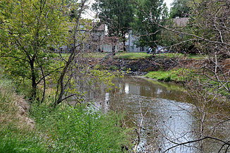
The upper reaches of the James River at Jamestown |
||
| Data | ||
| Water code | US : 1261082 | |
| location | North Dakota , South Dakota (USA) | |
| River system | Mississippi | |
| Drain over | Missouri → Mississippi → Gulf of Mexico | |
| source | in Wells County in North Dakota 47 ° 28 '53 " N , 99 ° 51' 32" W |
|
| muzzle | in the Missouri River coordinates: 42 ° 52 ′ 17 " N , 97 ° 17 ′ 26" W 42 ° 52 ′ 17 " N , 97 ° 17 ′ 26" W.
|
|
| length | 1143 km | |
| Medium-sized cities | Aberdeen | |
|
James River catchment area |
||
|
James River in Jamestown ND |
||
The James River (also called the Jim River or Dakota River ) is a 1,143 km long river in the northern United States .
It rises in Wells County in the US state of North Dakota , about 16 km northwest of the city of Fessenden. The river then flows through South Dakota, always roughly south, and forms the most important outflow of the plain between the two plateaus Coteau du Missouri and Coteau des Prairies in the center of Dakota. This basin, through which the James River flows today, was formed by a glacier tongue during the last ice age .
In the town of Jamestown , Jamestown Dam was built, which damms the river to Jamestown Reservoir . The river eventually joins the Missouri River on the Nebraska border .


