Jeans magnière
| Jeans magnière | ||
|---|---|---|
|
|
||
| local community | Chalmazel jeans magnière | |
| region | Auvergne-Rhône-Alpes | |
| Department | Loire | |
| Arrondissement | Montbrison | |
| Coordinates | 45 ° 44 ′ N , 3 ° 50 ′ E | |
| Post Code | 42920 | |
| Former INSEE code | 42114 | |
| Incorporation | January 1, 2016 | |
| status | Commune déléguée | |
| Website | http://www.jeansagniere.fr/ | |
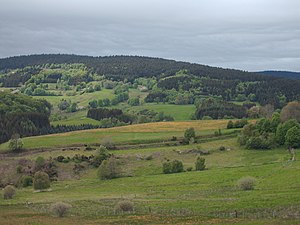
 View of Jeansagnière |
||
Jeansagnière is a town and commune Déléguée in the French commune of Chalmazel-Jeansagnière with 95 inhabitants (as at 1st January 2017) in the department of Loire in the region Auvergne Rhône-Alpes .
geography
Jeansagnière is located around 54 kilometers northwest of Saint-Étienne on the eastern edge of the Regional Nature Park Livradois-Forez (French: Parc naturel régional du Livradois-Forez ) in the Lignon du Forez valley . Jeansagniére lies at the foot of the Monts du Forez mountain range and its highest mountain, Pierre-sur-Haute .
history
Jeansagnière has been part of the Chalmazel-Jeansagnière municipality since January 1, 2016 . The municipality of Jeansagnière previously belonged to the arrondissement of Montbrison and the canton of Boën-sur-Lignon .
