
Jed Water
| Jed Water | ||
 The Canongate Bridge in Jedburgh |
||
| Data | ||
| location | Scottish Borders , Scotland | |
| River system | tweed | |
| Drain over | Teviot → Tweed → North Sea | |
| source | Confluence of several streams in Wauchope Forest 55 ° 21 ′ 7 ″ N , 2 ° 35 ′ 27 ″ W |
|
| muzzle | At Bonjedward in the Teviot coordinates: 55 ° 30 '45 " N , 2 ° 32' 22" W 55 ° 30 '45 " N , 2 ° 32' 22" W.
|
|
| length | 35 km | |
The Jed Water is a river in the Scottish Council Area Scottish Borders or in the traditional county of Roxburghshire .
Run
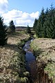
Jed Water is created by the confluence of several streams in the Wauchope Forest in the Cheviot Hills . The source streams reach up to the slopes of the Carlin Tooth a few hundred meters from the Scottish-English border. The upper reaches of the Jed Waters is called Raven Burn . There are different information about the confluence from which the stream is called Jed Water .
The approximately 35 kilometers long course of the Jed Waters essentially follows a northerly direction. The Jed Water receives numerous streams along its course. However, it has no significant tributaries. At Bonjedward , around three kilometers north of Jedburgh , the Jed Water flows into the Teviot , which eventually drains into the North Sea via the Tweed .
The upper reaches of the Jed Waters

Crossing the A68


-