
River Teviot
| River Teviot | ||
 |
||
| Data | ||
| location | United Kingdom | |
| River system | River Tweed | |
| Drain over | River Tweed → North Sea | |
| River basin district | Solway Tweed | |
| source | Comb Hill 55 ° 19 ′ 26 ″ N , 2 ° 58 ′ 19 ″ W. |
|
| muzzle |
Tweed coordinates: 55 ° 19 ′ 52 " N , 2 ° 57 ′ 18" W 55 ° 19 ′ 52 " N , 2 ° 57 ′ 18" W.
|
|
The River Teviot , even Teviot Water (debate /tiːvi.ət/, Scottish / tiːvijɪʔ /) is a river in the region Scottish Borders in Scotland . It belongs to the Tweed river system .
The River Teviot has its source in the western Comb Hills on the border with Dumfries and Galloway , from there it flows northwest through the Teviotdale , through Hawick and Roxburgh before it flows into the River Tweed southeast of Kelso .
The Borders Abbeys Way long-distance hiking trail leads along the River Teviot to the Tweed.
Its tributaries include Allan Water , Borthwick Water , Slitrig Water , Ale Water , Jed Water and Kale Water , the latter two with a length of 32 km each.
Picture gallery

In Hawick

At Roxburgh
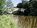
Martin's Bridge

Winter mood


Web links
Commons : River Teviot - collection of images, videos and audio files
- Map of Teviot and Tweed (accessed May 5, 2012)