Jegindø
| Jegindø | ||
|---|---|---|
| Jegindø Kirke, Jegindø Church. | ||
| Waters | Limfjord | |
| Geographical location | 56 ° 39 '5 " N , 8 ° 36' 54" E | |
|
|
||
| length | 6 km | |
| width | 3 km | |
| surface | 7.91 km² | |
| Highest elevation | 13 m | |
| Residents | 389 (January 1, 2020) 49 inhabitants / km² |
|
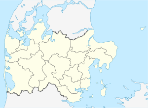
Jegindø (locally called Jenø) is a Danish island in the Limfjord , east of the Thyholm peninsula, with which it has been connected by a dam (Kirkebakken) since 1916 . Jegindø forms its own parish municipality ( Danish : Sogn ) Jegindø Sogn , which belonged to Harde Refs Herred in Thisted Amt until 1970 , from 1970 to Thyholm Kommune in what was then Ringkjøbing Amt , which became part of Struer Kommune in the course of local reform on January 1, 2007 has risen in the Midtjylland region.
landscape
The 7.91 km² island is approximately 6 km long and 3 km wide. The landscape consists mainly of pastureland with scattered groups of trees and extensive wet meadows facing the sea. There are no elevations worth mentioning, the highest point on the island is just 13 m above sea level . The north-west of the island is particularly natural, as it was not possible to build on it due to the low altitude above sea level.
Originally, today's island consisted of two smaller ones, separated by a sound. Later this had dried out as part of the land elevation and can still be recognized by a series of low-lying and marshy meadows. During particularly strong storm surges, the sea still divides the island into its original halves.
The strait between Thyholm and Jegindø is called Tambosund . Before the dam was built, there was only one ferry connection. The ferry rights then lay with the host of the inn in the village of Tambohuse , which is on Thyholm.
Residents
The 389 inhabitants (January 1, 2020) of the island are spread over several small villages and scattered courtyards. Larger places include Jegindø, Kirkeby, Ibstedt and the popular holiday and seaside resort Bøhl, which is located in the north of the island. There are also good beaches in the south of the island, where it ends in a narrow headland, the so-called cones or Jegind Tap . Jegindø also has a church and a small fishing port and marina with the Æ Fywerhus fishing museum .
Individual evidence
- ↑ a b statistics banks -> Befolkning og valg -> BEF4: Folketal pr. January 1st demands på øer (Danish)
- ↑ Danmarks Statistics : Statistical Yearbook 2009 - Geography and climate, Table 3 Area and population. Regions and inhabited islands (English; PDF; 39 kB)

