Johnson River (Kuskokwim River)
| Johnson River | ||
|
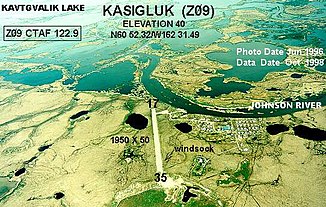
Kasigluk on the banks of the Johnson River |
||
| Data | ||
| Water code | US : 1404198 | |
| location | Alaska (USA) | |
| River system | Kuskokwim River | |
| Drain over | Kuskokwim River → Bering Sea | |
| origin |
Arhymot Lake , north of Kalskag 61 ° 39 ′ 8 ″ N , 160 ° 39 ′ 12 ″ W |
|
| Source height | 16 m | |
| muzzle |
Kuskokwim River , 23 km southwest of Bethel Coordinates: 60 ° 39 ′ 13 ″ N , 162 ° 6 ′ 32 ″ W 60 ° 39 ′ 13 ″ N , 162 ° 6 ′ 32 ″ W |
|
| Mouth height | 0 m | |
| Height difference | 16 m | |
| Bottom slope | approx. 0.05 ‰ | |
| length | approx. 340 km | |
| Left tributaries | Kvichavak River , Pikmiktalik River | |
| Right tributaries | Putu Creek | |
| Communities | Kasigluk , Nunapitchuk | |
The Johnson River is an approximately 340 km long right tributary of the Kuskokwim River in the Yukon-Kuskokwim Delta in southwest Alaska .
The river has its source in Arhymot Lake in the Yukon-Kuskokwim Portage north of Kalskag . The Johnson River initially flows in a south-westerly direction between the Yukon and Kuskokwim Rivers through an extensive lake system, turns at the lower reaches to the southeast and flows into the Kuskokwim River 24 km southwest of Bethel near the confluence with Kuskokwim Bay .
The name of the river used regionally was documented by the US Coast and Geodetic Survey in 1949 . The river is believed to be named after Eric Johnson, a prospector . The Eskimos attributed the water to the Kvichavak River .
