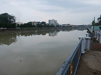
Johor (river)
| Johor | ||
|
Looking west at the mouth of the Johor with the Sungai Johor Bridge . The tributary on the left is the Lebam (Sungai Lebam) |
||
| Data | ||
| location |
|
|
| River system | Johor | |
| origin | am Berg Gemuruh 1 ° 49 '0 " N , 103 ° 42' 0" O |
|
| Source height | 109 m | |
| muzzle | in the Strait of Johor Coordinates: 1 ° 27 ′ 0 ″ N , 104 ° 1 ′ 0 ″ E 1 ° 27 ′ 0 ″ N , 104 ° 1 ′ 0 ″ E |
|
| Mouth height | 0 m | |
| Height difference | 109 m | |
| Bottom slope | 0.89 ‰ | |
| length | 122.7 km | |
| Catchment area | 2636 km² | |
| Discharge at the gauge Rantau Panjang A Eo : 1130 km² |
NNQ (02/26/1976) MNQ MQ Mq MHQ HHQ (12/11/1969) |
2.1 m³ / s 7.2 m³ / s 37.5 m³ / s 33.2 l / (s km²) 265.4 m³ / s 587.9 m³ / s |
| Left tributaries | Linggui; Lebam | |
| Right tributaries | Sayong ; Semengar; Tiram | |
| Medium-sized cities | Kota Tinggi | |
| Residents in the catchment area | 220,000 | |
The Johor ( Malay Sungai Johor ) is a river at the southeast end of the Malay Peninsula in the state of Johor .
course
The 122.7 km long river has its source on Mount Gemuruh. The last 20 km of the river bed run through mangrove forest . At the mouth it is about 3.5 km wide.
Floods
The Johor made headlines at the turn of the year 2006–2007, when almost 100,000 people around the town of Kota Tinggi had to be evacuated after a heavy rain event in the region .
Individual evidence
- ↑ a b c d Sungai Johor. (PDF; 1.1 MB) (No longer available online.) Archived from the original on September 15, 2012 ; Retrieved February 3, 2011 . Info: The archive link was inserted automatically and has not yet been checked. Please check the original and archive link according to the instructions and then remove this notice.
- ↑ Extreme Flood Event: A Case Study on Floods of 2006 and 2007 in Johor, Malaysia. (PDF; 5.2 MB) Retrieved February 3, 2011 .
