Kölpinsee (Uckermark)
| Kölpinsee | ||
|---|---|---|

|
||
| Geographical location | Uckermark district | |
| Drain | Milmersdorfer Mühlenbach | |
| Places on the shore | Götschendorf , Milmersdorf | |
| Data | ||
| Coordinates | 53 ° 6 '33 " N , 13 ° 39' 56" E | |
|
|
||
| Altitude above sea level | 66.2 m above sea level HN | |
| surface | 1.63 km² | |
| Maximum depth | 10 m | |
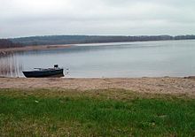
The Kölpinsee is the second highest lake in the course of the Havel inflow Templin waters . It is located north of Götschendorf on the territory of the municipality of Milmersdorf and has a catchment area of 12.6 square kilometers. Politically it belongs to the Uckermark and with an area of 163 hectares is probably the seventh largest lake in this district. In the natural spatial structure , however, it is assigned to the Schorfheide .
The lake is almost completely surrounded by forest. Much of the bank is lined with swamp forests and reed belts. There are therefore only a few places where the lakeshore can be reached with dry feet.
The lake belongs to the Elbe river system due to its drainage route . It is close to the North Sea-Baltic Sea watershed , because the Ucker catchment area begins 300 m to the east .
The late medieval tower ruins on the Kölpinsee are located on the lake as the remains of a small square granite block.
Web links
- Profile of the lake (PDF; 192 kB)
Individual evidence
- ↑ Natural spatial structure of Brandenburg according to Scholz. State Office for Environment, Health and Consumer Protection , March 19, 2015, accessed on November 7, 2015 .
- ↑ Felix Biermann , Christof Krauskopf, Susanne Hanik: The late medieval tower ruins on the Kölpinsee, district Götschendorf, district of Uckermark. at academia.edu


