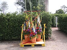
Königswiesen (Schleswig)

The Königswiesen ( Danish : Kongeengen , partly as in German also in the plural Kongeengene ) is an approximately 16 hectare city park in the city of Schleswig . The park extends west of the old town on the north bank of the Kleinen Breite der Schlei . Across from the Königswiesen is the Seagull Island . Immediately north of the park is the Lollfuß (dä. Lolfod ) district. In the run-up to the state horticultural show held in Königswiesen in 2008 , the park was redesigned in terms of landscape architecture.
The central design element is the approximately 420-meter-long Schleikanal, which cuts through the park in a west-east direction and optically connects the Schleswig Cathedral with the tower of Gottorf Castle . The canal flows into the Schlei at the western end. To the north of the canal is an approximately 14-meter-high observation tower . The playground on the site is designed as a Viking playground. To the west is the Louisenbad, a public bathing area. There are also two local sailing clubs and the local Danish rowing club. Not far from here is a small open air stage ( Schlei stage ). Several times a year the park is the venue for larger events such as the Viking Days or, since 2018, the Norden - The Nordic Arts Festival.
The name probably goes back to the Danish King Svend Grathe , who donated the area to the city in a letter in 1155. The first Schleswig town charter probably goes back to Svend Grathe.
Web links
Individual evidence
- ↑ Laga Schleswig-Schleiregion: Here the north blossoms (pdf)
- ↑ Viking days
- ↑ Holger Bruun: Gamle danske less eller skildringer, fortællinger og sagn om Danmarks byer, kirker og klostre, kongeborge og slotte, herregaarde including mindeværdige steder i ældre tider , Volume 3, København 1869, p. 438
Coordinates: 54 ° 30 ′ 45 ″ N , 9 ° 33 ′ 38 ″ E


