
Kaindy chain
| Kaindy chain | ||
|---|---|---|
| Highest peak | . ( 5784 m ) | |
| location | Issyk Kul ( Kyrgyzstan ) | |
| part of | Tienschan | |
|
||
| Coordinates | 42 ° 4 ′ N , 79 ° 47 ′ E | |
| rock | Mica schist , limestone | |
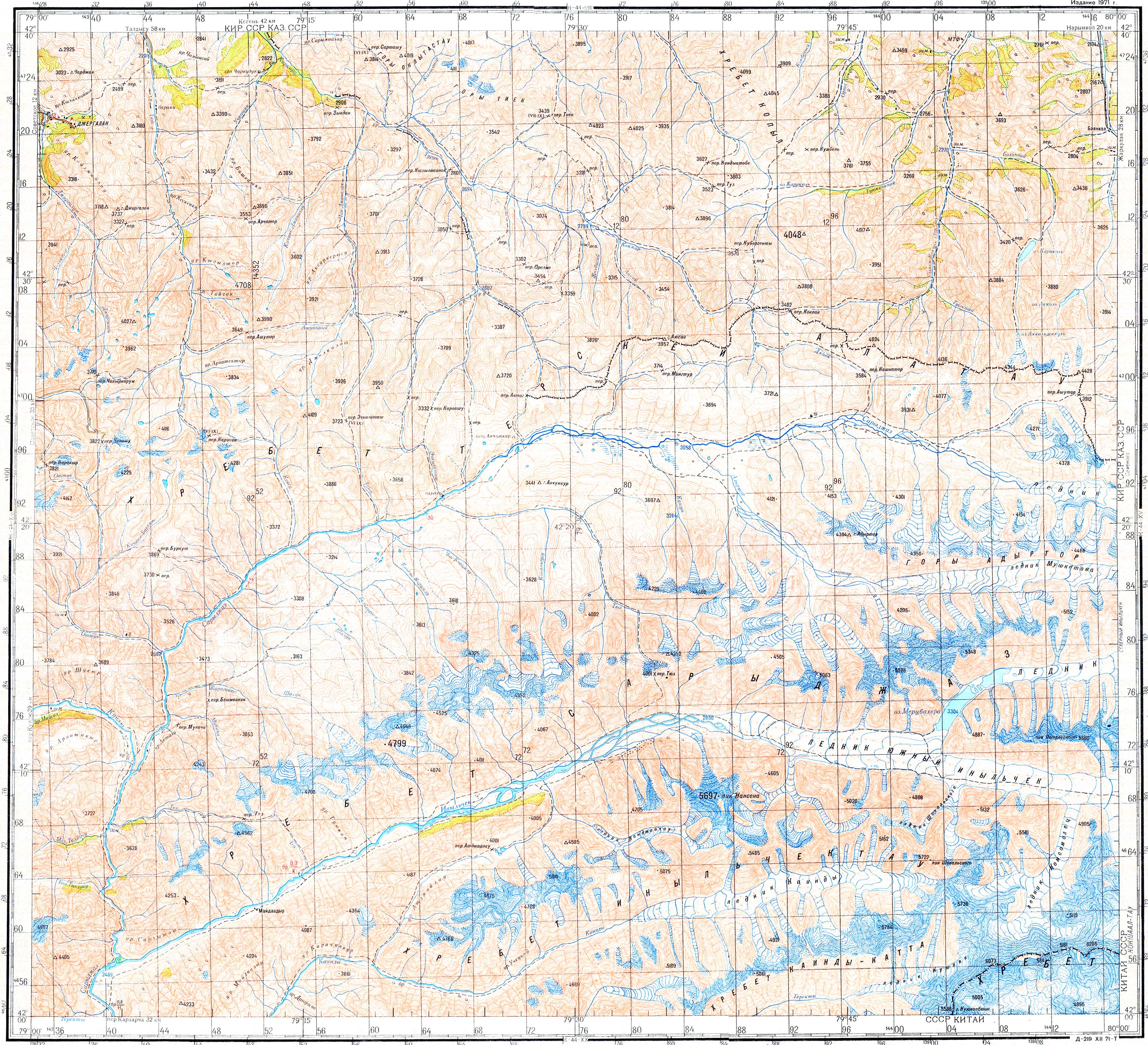
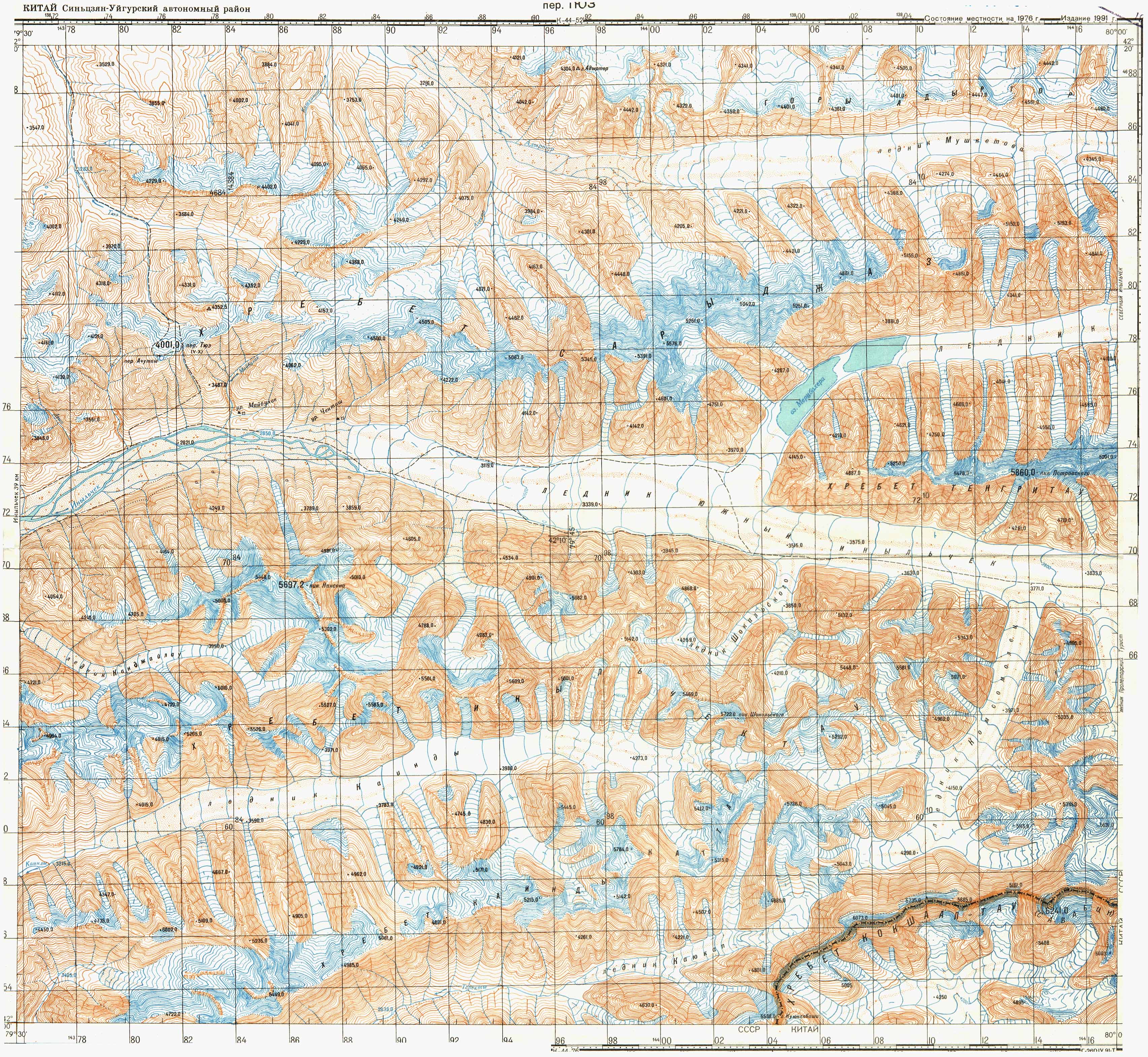
 Location of the Kaindy chain south of the Kaindy river valley and Kaindy glacier |
||

The Kaindy Range ( Kyrgyz Кайыңды, кырка тоо ; Russian Каинды-Катта хребет ) is a mountain range in southeast Kyrgyzstan .
The Kaindy chain forms a mountain range that branches off from the main ridge of the Tienschan to the north and extends south of the Kaindy river valley and the Kaindy glacier, parallel to the Engiltschek chain running north, over a length of 65 km in an east-west direction. In the south, the mountain range is bounded by the Kajukap Glacier ( Lednik Kajukap ) and further west by the Terekti River, which is fed from it . The mountain range consists mainly of metamorphic mica schist and limestone . The Kaindy chain is mostly covered by firn and glaciers . The higher eastern part reaches a maximum height of 5784 m and is completely glaciated. The highest peak of the Tienschan, the Dschengisch Tschokusu , is only 20 km further east. Rocks and rubble emerge on the mountain slopes. The lower layers in the western part of the mountain range are characterized by alpine heathland.
Web links
- Sheet 0/14 Inylchek - Tien Shan, Kyrgyzstan , Alpine Club Map 1: 100,000
- Map sheet k-44-14 of the Soviet General Staff Map 1: 200,000
- Map sheet k-44-064 of the Soviet General Staff Map 1: 100,000