Kananaskis River
| Kananaskis River | ||
| Data | ||
| location | Alberta (Canada) | |
| River system | Nelson River | |
| Drain over | Bow River → South Saskatchewan River → Saskatchewan River → Nelson River → Hudson Bay | |
| origin | Lower Kananaskis Lake ( Canadian Rockies ) 50 ° 37 ′ 5 ″ N , 115 ° 7 ′ 9 ″ W |
|
| Source height | approx. 1680 m | |
| muzzle |
Bow River Coordinates: 51 ° 5 '46 " N , 115 ° 3' 44" W 51 ° 5 '46 " N , 115 ° 3' 44" W. |
|
| Mouth height | approx. 1280 m | |
| Height difference | approx. 400 m | |
| Bottom slope | approx. 5.7 ‰ | |
| length | approx. 70 km | |
| Catchment area | approx. 950 km² | |
| Discharge A Eo : 899 km² Location: 10 km above the mouth |
MQ 1975/2012 Mq 1975/2012 |
13.7 m³ / s 15.2 l / (s km²) |
| Discharge A Eo : 933 km² Location: 9 km above the mouth |
MQ 1912/1961 Mq 1912/1961 |
15.4 m³ / s 16.5 l / (s km²) |
| Right tributaries | Lusk Creek | |
| Reservoirs flowed through | Barrier Lake , Lower Kananaskis Lake , Upper Kananaskis Lake | |
|
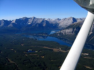
Headwaters of the Kananaskis River: Upper and Lower Kananaskis Lake |
||
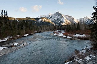
The Kananaskis River is an approximately 70 km long right tributary of the Bow River in the southwest of the Canadian province of Alberta .
River course
The headwaters of the Kananaskis River are located in Peter Lougheed Provincial Park in the Canadian Rockies on the North American continental divide . The 12 km long source river Upper Kananaskis River rises at an altitude of 2000 m south of Mount Jellicoe ( 3075 m ). It flows south and flows into the Upper Kananaskis Lake . Below this is Lower Kananaskis Lake , also a reservoir. Its southern end is considered to be the origin of the actual Kananaskis River . The Kananaskis River flows north through the mountains. The Alberta Highway 40 follows the river almost its entire route. After 55 km the river reaches Barrier Lake , a 4 km long reservoir. Below the Barrier Dam , the Kananaskis River flows 11 km before it reaches the Bow River. The Trans-Canada Highway crosses the river about 1.5 km above the mouth . The estuary is 20 km east of Canmore . Directly below the confluence of the Kananaskis River with the Bow River is the Seebe Dam with a run-of-river power station.
Hydrology
The catchment area of the Kananaskis River covers approximately 950 km². The mean discharge is 15.4 m³ / s.

