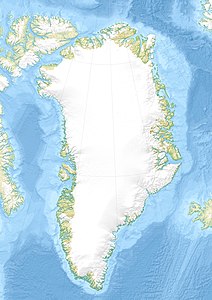
Kangerlussuaq (East Greenland)
| Kangerlussuaq Storfjord |
||
|---|---|---|
| Waters | Denmark Strait ( Atlantic Ocean ) | |
| Land mass | Greenland | |
| Geographical location | 68 ° 13 ′ N , 32 ° 2 ′ W | |
|
|
||
| length | 70 km | |
| Greatest water depth | 960 m | |
| Islands | Kraemer Ø | |
Kangerlussuaq (also outdated Kangerdlugssuaq ; German translation: "long fjord"; Danish name: Storfjord ) is a fjord in East Greenland on the border between the districts of Ammassalik in the south and Ittoqqortoormiit (Scoresbysund) in the north.
geography
The fjord begins at the edge of the Kangerlussuaq glacier and extends over 70 km to its confluence with the Denmark Strait between Cape Hammer and Cape Deichmann. In addition to the Kangerlussuaq glacier, the largest outlet glacier in eastern Greenland, several other glaciers calve into the Kangerlussuaq. The largest side fjords are the Nordfjord, Courtauld Fjord, Amdrupfjord ( Atterteq ) and Watkinsfjord ( Torsukattak ). Near its opening to the Atlantic, the fjord contains the island of Kraemer Ø , which is separated from the Skærgårdshalvø peninsula by the narrow Uttental Sound . Between Kraemer Ø and the confluence of the Amdrupfjord, the Kangerlussuaq is up to 960 meters deep. It continues on the sea floor to the edge of the continental shelf as a channel 500 to 750 m deep.
geology
A geological peculiarity at the entrance to the fjord is the Skærgård intrusion, discovered by Lawrence Rickard Wager in 1931 . The layered gabbro intrusion formed 54.4 million years ago is now exposed over an area of 11 km × 7.5 km. In the second half of the 1980s, the Canadian Platinova Resources Ltd. began . looking for platinum metals with exploratory drilling on the Skærgård peninsula. In 2013 gold deposits were estimated at 180 t, palladium at 270 t and platinum at 22 t.
history
The east coast of Greenland was settled by Paleoeskimos about 4000 years ago . It is likely that hunters visited the Kangerlussuaq. A found at Cape Irminger scraper from quartz proves that the region was visited by people about 2,000 years ago at the latest. Inuit inhabited the area from the late 13th to the early 19th centuries. Remnants of their houses were discovered in 1900 when the first Europeans reached the fjord on Georg Carl Amdrup's East Greenland expedition . The first excavations on the Skærgård peninsula were carried out by the Scoresbysund Committee's Second East Greenland Expedition under the direction of Ejnar Mikkelsen in 1932.
Web links
- Map section with Kangerlussuaq
Individual evidence
- ↑ Per Ivar Haug: Gazetteer of Greenland ( Memento from June 15, 2011 in the Internet Archive ) (= Til Opplysning No. 15), Trondheim University Library, Trondheim 2005, ISBN 82-7113-114-1 (English)
- ^ Kangerdlugssuaq Glacier. Atlas of Our Changing Environment, August 18, 2008, accessed March 14, 2014 .
- ↑ a b Christian Glahder: Hunting in Kangerlussuaq, Greenland East, 1951-1991. An Assessement of Local Knowledge (= Meddelelser om Grønland, Man & Society , No. 19, 1995), p. 10 (English)
- ↑ SL Bevan, AJ Luckman, T. Murray: Glacier dynamics over the last quarter of a century at Helheim, Kangerdlugssuaq and 14 other major Greenland outlet glaciers . In: The Cryosphere 6, 2012, pp. 923–937, 2012, doi: 10.5194 / tc-6-923-2012 (English)
- ^ The mineral raw material potential of Greenland (PDF; 9.2 MB), DERA raw material information, Hanover 2010
- ↑ Christian Glahder: Hunting in Kangerlussuaq, Greenland East, 1951-1991. An Assessement of Local Knowledge (= Meddelelser om Grønland, Man & Society , No. 19, 1995), p. 5 (English)
- ↑ Project Update and Activities (PDF; 1.9 MB), Platina Resources Ltd., February 26, 2014 (English)
- ↑ Christian Glahder: Hunting in Kangerlussuaq, Greenland East, 1951-1991. An Assessement of Local Knowledge (= Meddelelser om Grønland, Man & Society , No. 19, 1995), p. 12 (English)
- ↑ a b Skaergaard history on www.skaergaard.org (English)
