Cape Eve
| Cape Eve | ||
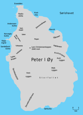
 Norwegian map of Peter I Øy with Evaodden (above) |
||
| Geographical location | ||
|
|
||
| Coordinates | 68 ° 46 ′ S , 90 ° 40 ′ W | |
| location | Peter I Island ( Antarctica ) | |
| Waters | Bellingshausen lake | |
Cape Eva ( Norwegian Evaodden ) is the northern cape of the Antarctic Peter I Island . It is preceded by cliffs and shallows over a length of 700 m . The cape separates the Lazarev Coast , which from here extends south along the entire west side of the island, from the Mirny Coast , which extends along the northeast coast.
The Norwegian captain Eyvind Tofte discovered and named the cape in 1927 during the Antarctic voyage of Odd I (1926–1927) financed by the Norwegian whaling entrepreneur Lars Christensen . The namesake is not known. The Advisory Committee on Antarctic Names converted the Norwegian name into English in 1952.
Web links
- Cape Eva in the Geographic Names Information System of the United States Geological Survey (English)
- Cape Eva on geographic.org (English)
