Karasu (Euphrates tributary)
|
Karasu Karasu Çayı, Karasu Deresi |
||
|
Roman bridge |
||
| Data | ||
| location | Gaziantep Province ( Turkey ) | |
| River system | Euphrates | |
| Headwaters |
Kartal Dağı 37 ° 17 ′ 28 ″ N , 37 ° 15 ′ 19 ″ E |
|
| Source height | approx. 800 m | |
| muzzle | near Tarlabaşı in the Euphrates Coordinates: 37 ° 24 ′ 5 " N , 37 ° 56 ′ 18" E 37 ° 24 ′ 5 " N , 37 ° 56 ′ 18" E
|
|
| length | approx. 100 km | |
| Small towns | Araban | |
| Communities | Eskialtıntaş, Taşdegirmen, Altınpınar | |
|
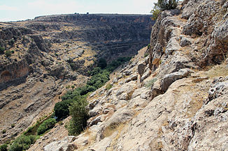
Karasu gorge near the mouth of the late Hittite rock relief |
||
The Karasu ( Turkish for "black water" ); also Karasu Çayı or Karasu Deresi , is a right tributary of the Euphrates in the Turkish province of Gaziantep .
The river has its source in the eastern foothills of the Kartal Dağı between the districts of Araban and Pazarcık . It flows east, digs a gorge up to 200 meters deep in front of the mouth and flows into the Euphrates in the east of the Araban district .
The river is not identical to the source river of the same name of the Euphrates.
history
In the late Hittite period , the border between the kingdoms of Kummaḫa and Karkamišša ran nearby . About three kilometers (as the crow flies) west of the mouth there is a rock relief from this time at the top of the gorge . One kilometer west of it lies the ruins of a Roman bridge, called Karasu Köprüsü, on the river . It was part of the military road that connected the villages of Zeugma and Samosata . Both belonged to the historic Kommagene landscape .
Web links
Individual evidence
- ↑ Horst Ehringhaus : The end that was a beginning. Rock reliefs and rock inscriptions of the Luwian states of Asia Minor from 12. to 8./7. Century BC Chr. Nünnerich-Asmus, Mainz 2014, ISBN 978-3-943904-67-3 , pp. 95-101.

