Karlstein (Hornberg)
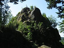
The Karlstein is a rock formation and the summit ( 968.9 m ) of the Hauenstein mountain in the Niederwasser district of the Hornberg municipality . It is located in the Middle Black Forest on the western route from Pforzheim to Basel. It offers a particularly beautiful view to the east, north and south, the view to the west is obscured by forest, as the western ridge reaches almost the height of the rock.
The rock used to be called Hauenstein like the entire mountain . It was renamed after Duke Karl Eugen von Württemberg climbed this summit on July 23, 1770. At that time the Karlstein was the highest mountain peak in Württemberg . With the signing of the Rhine Federation Act in 1806, the Black Ridge became the highest mountain peak. At this point in time, the highest point in Württemberg was already the Dreifürstenstein below the summit of the Hornisgrinde .
The Karlstein marked a four-country corner until 1805, where the states of Baden and Württemberg, as well as the Fürstenberg and front Austrian possessions met. With the Peace of Bratislava on December 26, 1805, the Austrian and Fürstenberg parts fell to Baden. With the border treaty of October 2, 1810 between the Kingdom of Württemberg and the Grand Duchy of Baden , Hornberg and thus also the Württemberg part of the Karlstein came to Baden.
The rock consists of granite blocks that show wool sack weathering . Kaolinite can also be found nearby as a weathering rock. To the east, the rock drops steeply about 20 meters.
Several bowl-shaped depressions can be seen in the rock. Finds of stone tools about 200 meters away suggest that it was made in the Neolithic Age, a place of worship or perhaps a settlement. However, opinions differ, as natural erosion processes could also have created the shells. There are other stones with bowl-shaped depressions in the immediate vicinity.
The Karlstein is protected both as a natural monument and as a geotope .
literature
- Friedrich Walter : The Karlstein and the Black Forest trip of Duke Karl Eugen of Württemberg 1770. In: The Ortenau. Journal of the Historical Association for Central Baden. 9. Issue 1922, pp. 31-41 ( online ).
- City administration Hornberg (ed.): 900 years Hornberg , Konkordia, Bühl (Baden) 1993.
Web links
- Geotope profile of the State Office for Geology, Raw Materials and Mining , accessed on January 31, 2017
- Profile of the extensive natural monument in the LUBW's list of protected areas
Individual evidence
- ^ Kurt Walenta: The minerals of the Black Forest and their sites , Weise, Munich, 1992
Coordinates: 48 ° 11 '49.2 " N , 8 ° 11' 4.9" E

