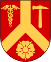
Katrineholm (municipality)
| Katrineholm municipality | |||||
|---|---|---|---|---|---|
|
|||||
| State : | Sweden | ||||
| Province (län): | Södermanland County | ||||
| Historical Province (landskap): | Södermanland | ||||
| Main place: | Katrineholm | ||||
| SCB code: | 0483 | ||||
| Residents : | 34,755 (December 31, 2019) | ||||
| Area : | 1,189.5 km² (January 1, 2016) | ||||
| Population density : | 29.2 inhabitants / km² | ||||
| Website : | www.katrineholm.se | ||||
| List of municipalities in Sweden | |||||
Coordinates: 59 ° 0 ′ N , 16 ° 12 ′ E Katrineholm is a municipality ( Swedish commun ) in the Swedish province of Södermanland County and the historical province of Södermanland . The main town of the municipality is Katrineholm . Other localities in the municipality are Bie , Björkvik, Forssjö, Julita / Äsköping, Sköldinge, Strångsjö and Valla.
history
The area around Katrineholm has been inhabited for more than 6000 years. Some remains such as Glysa's grave can be seen at Katrineholm.
The municipality of Katrineholm was created in 1971 by merging the former municipalities of Katrineholm, Björkvik, Floda, Julita, Sköldinge and Stora Malm.
Attractions
Katrineholm is surrounded by many lakes. The best known are the Kolsnaren and the viruses . The most interesting excursion destinations are the Djulö amusement park, the Julita open-air museum and Ericsberg Castle .
Personalities
- The former Swedish Prime Minister Göran Persson (* 1949) was a local councilor in Katrineholm from 1984 to 1989.
- The former singer of the Finnish metal band Nightwish , Anette Olzon , was born in 1971 in Katrineholm.
Web links
- Official website (Swedish)
swell
- ↑ Folkmängd i riket, län och kommuner December 31, 2019 at Statistiska centralbyrån
- ↑ Kommunarealer January 1, 2016 at Statistiska centralbyrån (including all inland waters)


