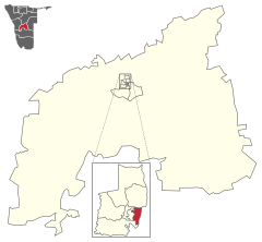
Katutura East
 Details |
Constituency Katutura East |
| Basic data | |
|---|---|
|
State region |
Namibia Khomas |
|
Population area District administrative seat |
21,564 (2011) 3 Windhoek |
| Election information | |
|
Registered voters |
|
Katutura East ( English Katutura East ) is a constituency in Windhoek suburb of Katutura in the region Khomas in Namibia . It has almost 21,500 inhabitants (2011) who live on an area of three square kilometers .
Individual evidence
- ↑ 2011 Population and Housing Census, Khomas Regional Tables based on the 4th Delimitation. Namibia Statistics Agency, 2014, p. 3ff ( Memento of the original from February 24, 2015 in the Internet Archive ) Info: The archive link was inserted automatically and has not yet been checked. Please check the original and archive link according to the instructions and then remove this notice. accessed on February 24, 2015
- ↑ Khomas 2011. Census Regional Profile Namibia Statistics Agency, 2011, p. 4 ( Memento of the original dated September 6, 2014 in the Internet Archive ) Info: The archive link was inserted automatically and has not yet been checked. Please check the original and archive link according to the instructions and then remove this notice. accessed on February 24, 2015
Coordinates: 22 ° 31 ′ S , 17 ° 4 ′ E

