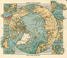
Keenan Land
Keenan Land is the name of a phantom island in the Beaufort Sea , about 500 km north of Alaska .
In the 1870s, the whaler John Keenan (1835–1910) reported that he had driven his barque Stamboul north in bad weather when he and all his men had seen land in the north in the breaking fog. According to other sources, he is said to have entered the country and hoisted the US flag. The naturalist Marcus Baker (1849-1903) proposed in 1893 that the island, whose possible existence is in line with the Eskimo legends about a country in the north, should be named Keenan Island . On some maps of this time it was to be found as Kennan Land (e.g. in Stieler's Hand Atlas from 1891) or Keenan Land (e.g. in Adolf Stieler's Hand Atlas from 1907). In 1904, the American hydrographer Rollin Arthur Harris (1863-1918) emerged with the theory of the existence of an Arctic continent, which was based on observations of the tides and ocean currents , but which also seemed to be supported by Keenan's report. A staunch critic of this theory was Fridtjof Nansen .
The first scientific expedition that attempted to reach Keenan Land was the Anglo-American Polar Expedition 1906-1908, led by Ejnar Mikkelsen and Ernest de Koven Leffingwell (1875-1971). However, they had to break off their advance from Flaxman Island off the coast of Alaska after 200 km. The Canadian Arctic Expedition 1913–1916 , led by Vilhjálmur Stefánsson , came closer to the assumed location of Phantom Island . She discovered no land, and depth plumbing did not suggest a land near either. In 1926 Roald Amundsen , Lincoln Ellsworth and Umberto Nobile flew over the area in question with the airship Norge . Unfortunately they had no view of the ice south of 85 ° North due to heavy fog. Hubert Wilkins , who had tried to "rediscover" Keenan Land from an airplane as early as 1926 to 1928 , flew over large parts of the area in 1937 in his search for the missing Sigismund Lewanewski and came to the conclusion that there was no land anywhere.
The US Air Force pilot Joseph O. Fletcher found a possible explanation for the sighting of Keenan Land in 1946. While flying over the Beaufort Sea, he registered an unusual radar signal and discovered an ice island of gigantic proportions. Thicker and harder than the surrounding ice floes, it took up an area of 520 km². From afar, their valleys and hills could be mistaken for land.
Individual evidence
- ↑ Edward Perry Herendeen: An undiscovered Island off the Northern Coast of Alaska II . In: National Geographic Magazine 5, 1894, pp. 78-80
- ↑ Capt. John Keenan . In: The Troy Times , March 12, 1910, accessed January 16, 2014
- ↑ Marcus Baker: An undiscovered Island off the Northern Coast of Alaska . In: National Geographic Magazine 5, 1894, pp. 76-78
- ^ Adolf Stieler's hand atlas about all parts of the earth and about the world structure , Justus Perthes, Gotha 1891
- ↑ Stieler's Hand Atlas , ninth edition, completely revised and re-engraved, Justus Perthes, Gotha 1907
- ^ RA Harris: Some Indications of Land in the Vicinity of the North Pole . In: National Geographic Magazine 15, 1904, pp. 255-261
- ^ Fridtjof Nansen: On North Polar Problems . In: Geographical Journal 30, 1907, pp. 469-487 and pp. 585-601
- ^ William James Mills: Exploring Polar Frontiers - A Historical Encyclopedia . tape 1 . ABC-CLIO, 2003, ISBN 1-57607-422-6 , pp. 72 ( limited preview in Google Book search).
- ↑ Richard Diubaldo: Stefansson and the Canadian Arctic . McGill-Queen's University Press, 1978, ISBN 0-7735-1815-0 , pp. 17 ( limited preview in Google Book search).
