Kellerberg (Siebenhirten)
| Kellerberg | ||
|---|---|---|
|
Kellerberg, view from the north |
||
| height | 233 m above sea level A. | |
| location | Vienna - Lower Austria border | |
| Mountains | Vienna Woods ( Vienna Basin ) | |
| Coordinates | 48 ° 7 ′ 20 " N , 16 ° 18 ′ 45" E | |
|
|
||
| particularities | Occurrence of brick clay, today an urban area | |
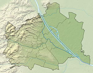
The Kellerberg is 233 m above sea level. A. high hill in the south of the city of Vienna , on the border with the industrial district of Lower Austria .
Location and landscape
The Kellerberg rises south of the Wienerberg and the Liesing valley near Erlaa . It lies between the Petersbach in the north and the small Krotenbach in the south. It is slightly lower than the Wienerberg – Laaer-Berg -zug ( 251 m above sea level ) and much less extensive. In the southwest, after the area of Maria-Enzersdorf, follows the much higher calendar mountain in Mödling ( 332 m above sea level ).
In the north lies Siebenhirten , a district of Liesing , in the west towards the Vienna Woods Perchtoldsdorf , in the south-west Brunn am Gebirge , and in the east Vösendorf and in the south-east the Shopping City Süd . On the mountain are Viennese settlements and the Brunner Wolfholzsiedlung .
To the east passes the Süd Autobahn (A2), here it has the junction of the Wiener Außenring Autobahn (A21), which runs over the Kellerberg. On the mountain north of the A21 is the Kellersee and south of the same is the Wienerbergerteich .
History and nature
The old ski jumps are on the mountain . They were raised in the Thirty Years' War during the Swedish invasion in 1645 , but were not used, the fighting concentrated on Wolfsschanze in Brigittenau.
Until the 19th century, the mountain was only arable land. It is named after the extensive cellars of the former Schellenhof brewery , which existed from before 1719 to 1926. In the early days then here came the plants brick plants Wienerberger whose main production facilities in south Sulz- and Steinfeld to Neudorf near Vienna extended (Neudorfer brick plants) . The two ponds date from this time, they are former clay pits.
The A2 was built here as early as 1959-62, the A23 followed until 1968. In the 1980s, a second "shopping city" was under discussion on the Kellerberg, which was prevented by a citizens' initiative. A settlement of multi-storey apartment blocks was also planned for a time.
In 2002/03, seven hectares of the still undeveloped part of the forest and agricultural enterprise (MA 49) were redesigned into the Kellerberg Liesing-Siebenhirten recreation area .
Web links
Individual evidence
- ↑ The streets in Siebenhirten. On the ramparts. sevenhirten-wien.at (accessed February 21, 2017).
- ^ Roland Berger, Friedrich Ehrendorfer: Ecosystem Vienna: the natural history of a city. Volume 2 of Wiener Umweltstudien , Böhlau Verlag, Vienna 2011, ISBN 978-3-205-77420-4 , p. 451 f ( limited preview in the Google book search).
-
↑ Culture and sights: The Schellenhof brewery. sevenhirten-wien.at: Culture & Economy in Siebenhirten (accessed February 21, 2017) - with illustration of the work;
Stefan Felbermayer: The old seven-shepherd near Vienna. Self-published, Vienna 2009, ISBN 978-3-200-01701-6 , p. OA; Excerpt from the history of the place Siebenhirten , page 2, felbi-film.at ( web link to the book ; both accessed February 21, 2017); The return of the Liesinger beer. . Agnes Preusser, in mein district.at, July 12, 2016. - ↑ a b c Recreation area Kellerberg Liesing - Siebenhirten. wien.gv.at Recreation Areas (accessed February 21, 2017).


