Keret (lake)
| Keret | ||
|---|---|---|

|
||
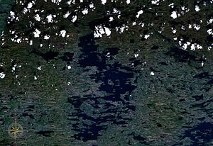
| Satellite image of the Keret | ||
| Geographical location | Republic of Karelia ( Russia ) | |
| Tributaries | Kapustnaja, Trawjanaja, Narva, Kirschewa | |
| Drain | Keret | |
| Data | ||
| Coordinates | 65 ° 54 ' N , 32 ° 55' E | |
|
|
||
| Altitude above sea level | 91 m | |
| surface | 223 km² | |
| length | 44 km | |
| width | 19 km | |
| Maximum depth | 60 m | |
| Middle deep | 4.5 m | |
| Catchment area | 1320 km² | |
The Keret ( Russian Кереть, Керет, Керетьозеро, Куккуреозеро , karel. Kierettijärvi ) is a lake in the Republic of Karelia in Russia .
The Keret is the eponymous river Keret to the White Sea drained out. The shoreline is severely cut. The water surface of the Keret is 223 km². Including the approximately 130 islands - the largest is Witschany - the total area is 275 km². The lake is 91 m above sea level. Its maximum depth is between 4 and 5 m. The southern part of the lake is called Pirtosero . In the north lies the partial lake Plotichnoye .
The lake is frozen between the beginning of November and the end of May. The water temperatures reach values of 20 to 21 ° C in summer.
The lake lies in a hilly landscape, in which granite appears in many places . The trunk road R21 Kola (also E 105 ) runs along its eastern bank between Saint Petersburg and Murmansk .
The keret is rich in fish. There are, among others, the following types of fish: perch , pike , whitefish and rutilus .
Web links
- По озеру Кереть (Russian)
Individual evidence
- ↑ a b c Keret (lake) in the State Water Register of the Russian Federation (Russian)
- ↑ a b c d e Article Keret (See) in the Great Soviet Encyclopedia (BSE) , 3rd edition 1969–1978 (Russian)

